
Image: Global spread of H5N1 map

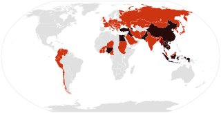
Description: Countries affected by the w:en:H5N1 virus Countries with humans, poultry and wild birds killed by H5N1.
Title: Global spread of H5N1 map
Credit: Own work. This file was derived from: Global spread of H5N1 map.PNG BlankMap-World6.svg by User:Shizhao and w:en:User:Canuckguy on 2006-02-17 and 2006-11-12 respectively. Former released under
 |
Permission is granted to copy, distribute and/or modify this document under the terms of the GNU Free Documentation License, Version 1.2 or any later version published by the Free Software Foundation; with no Invariant Sections, no Front-Cover Texts, and no Back-Cover Texts.
A copy of the license is included in the section entitled "Text of the GNU Free Documentation License". Subject to disclaimers. |
and latter under Template:PD-self
Author: Cflm001 (talk)
Permission: Public domainPublic domainfalsefalse I, the copyright holder of this work, release this work into the public domain. This applies worldwide. In some countries this may not be legally possible; if so: I grant anyone the right to use this work for any purpose, without any conditions, unless such conditions are required by law.
Usage Terms: Public domain
License: Public domain
Attribution Required?: No
Image usage
The following page links to this image:
