
Image: GlossopMap

Size of this PNG preview of this SVG file: 549 × 599 pixels. Other resolution: 220 × 240 pixels.
Original image (SVG file, nominally 702 × 766 pixels, file size: 581 KB)
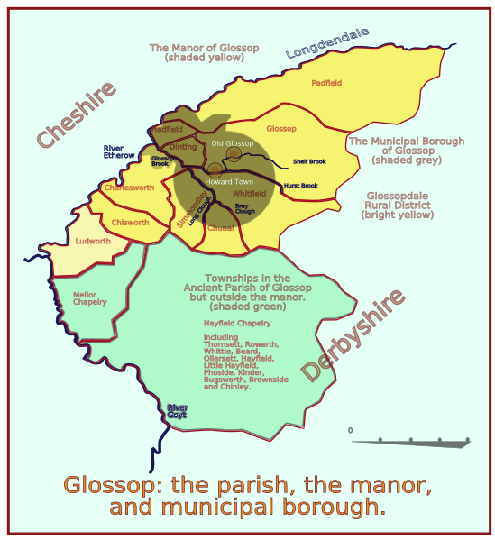
Description: A map of Glossop in Derbyshire, showing how the name has been attached to differing areas in the last 900 years. The original hamlet or township is now called Old Glossop, and Howard Town is now called Glossop. The manor occupied half area of the parish, and only a small area of the manor became the municipal borough, though a few extra acres were added later.
Title: GlossopMap
Credit: Own work
Author: ClemRutter
Usage Terms: Creative Commons Attribution-Share Alike 3.0
License: CC BY-SA 3.0
License Link: http://creativecommons.org/licenses/by-sa/3.0
Attribution Required?: Yes
Image usage
There are no pages that link to this image.

All content from Kiddle encyclopedia articles (including the article images and facts) can be freely used under Attribution-ShareAlike license, unless stated otherwise.