
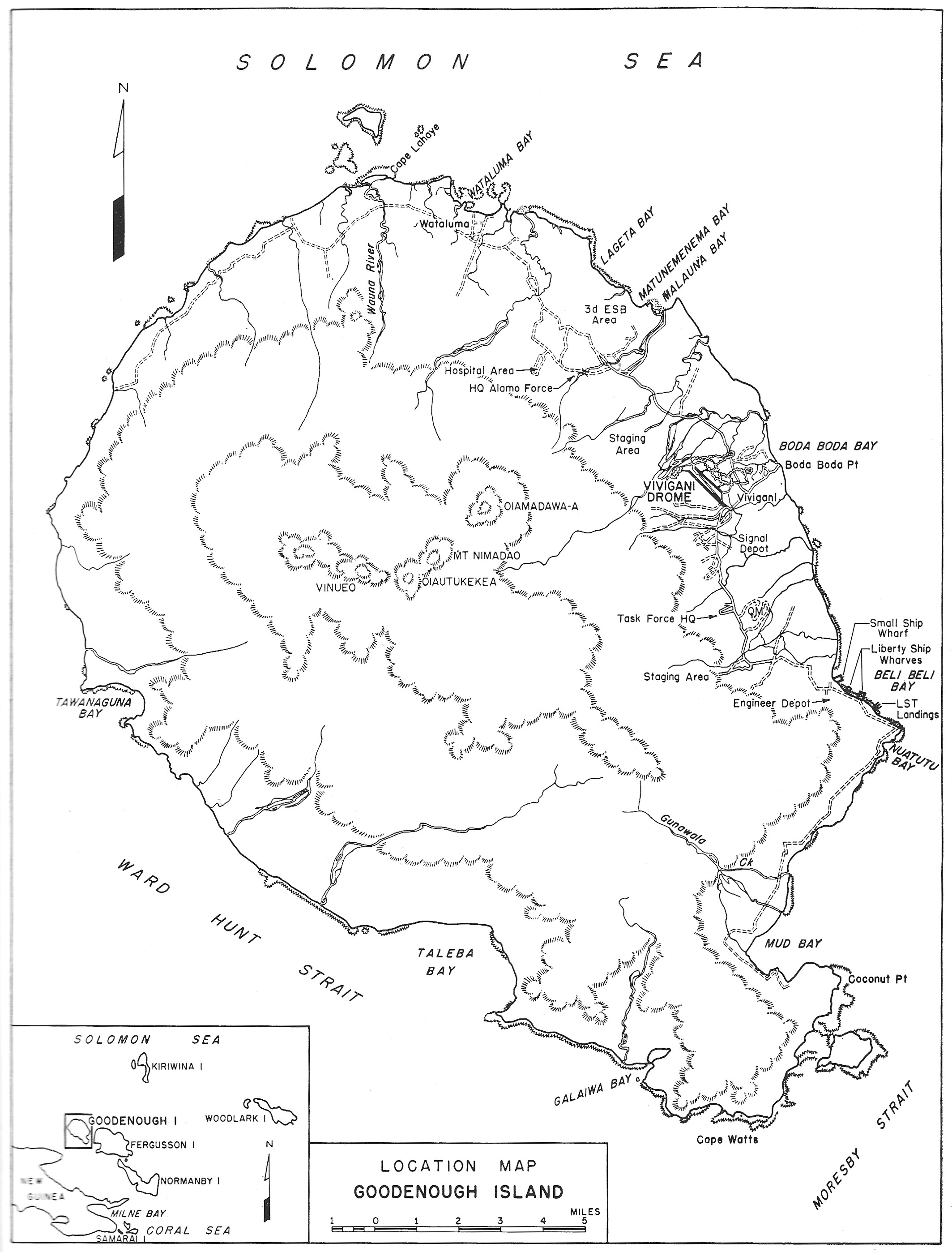
Image: Goodenough Island
Size of this preview: 456 × 599 pixels. Other resolutions: 182 × 240 pixels | 2,127 × 2,796 pixels.
Original image (2,127 × 2,796 pixels, file size: 733 KB, MIME type: image/jpeg)
Description: Map of Goodenough Island, showing location of wartime base development
Title: Goodenough Island
Credit: Airfield and Base Development (1951), p. 141. N.B. This is a US government work, written by staff of the Office of the Chief Engineer, U.S. Army, and published by the U.S. Government Printing Office. [1]
Author: Casey, Hugh J., ed.
Usage Terms: Public domain
License: Public domain
Attribution Required?: No
Image usage
The following page links to this image:

All content from Kiddle encyclopedia articles (including the article images and facts) can be freely used under Attribution-ShareAlike license, unless stated otherwise.