
Image: Grand Staircase-Escalante National Monument map overlay
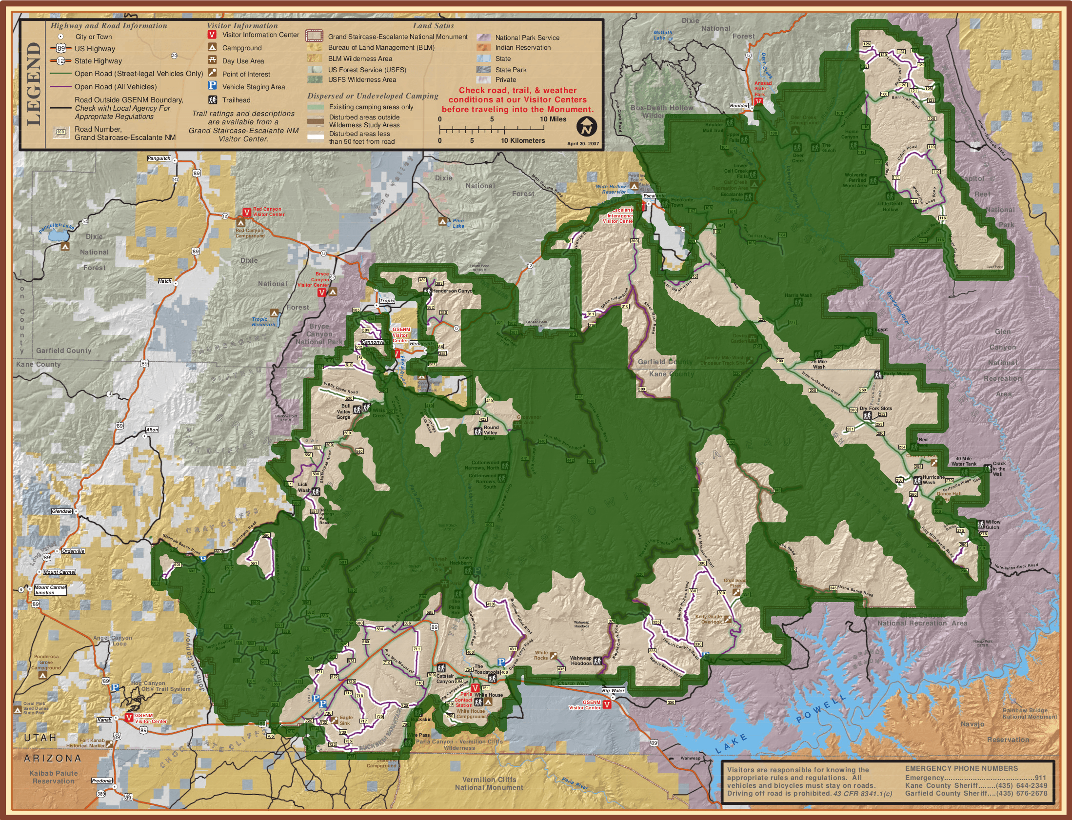
Description: Official park map from the Bureau of Land Management (BLM) website for Grand Staircase-Escalante National Monument (GSENM), Utah with an overlay added using GIMP to more clearly indicate the original monument boundaries using a thick green semi-transparent outline, and the new boundaries—proclaimed in December 2017—as semi-transparent shaded green areas. The Paria River separates the western shaded area into the Grand Staircase portion (to the west of the river—the left side of the map) and the Kaiparowits Plateau portion (to the east—the center of the map), while the Canyons of the Escalante are the shaded area to the northeast of the Hole-in-the-Rock Road which traverses the gap between the shaded areas, appearing as a thin green line heading southeast from Escalante. The Dry Fork slot canyons (Peekaboo, Spooky and Brimstone Canyons), along with most of the Hole-in-the-Rock Road and its tributary roads, and the Wahweap hoodoos and Toadstools to the southwest, have all been excluded from the new boundaries.
Title: Grand Staircase-Escalante National Monument map overlay
Credit: Wikimedia copy of 2007 park map
Author: Bureau of Land Management (BLM)
Usage Terms: Public domain
License: Public domain
Attribution Required?: No
Image usage
There are no pages that link to this image.
