
Image: Great Bitter Lake, Egypt
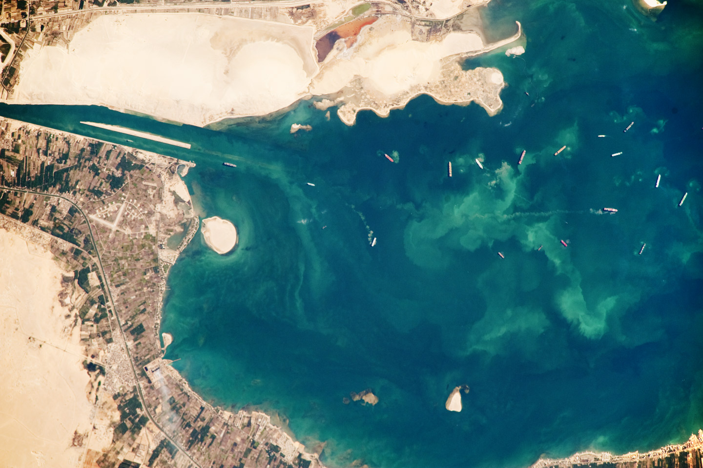
Description: Several ships, some under power and some anchored, are visible at image right. Large expanses of white and tan sandy sediments at image left and top attest to the desert conditions surrounding the lake. Located at the approximate midpoint of the Suez Canal, Great Bitter Lake is now filled with water derived from both the Red and Mediterranean Seas, and this steady influx of water balances the water lost to evaporation. The town of Fayid (also spelled as Fayed), visible along the western shore of the lake (bottom) is a tourist destination for residents of Cairo, particularly in the summer months. ISS Crew Earth Observations: ISS020-E-45018 Identification Mission ISS020 (Expedition 20) Roll E Frame 45018 Country or Geographic Name Egypt Features GREAT BITTER LAKE, FAYID, SUEZ CANAL, SHIPS Center Point Latitude 30.4° N Center Point Longitude 32.4° E Camera Camera Tilt 18° Camera Focal Length 800 mm Camera Nikon D3 Film 4256 x 2832 pixel CMOS sensor, 36.0mm x 23.9mm, total pixels: 12.87 million, Nikon FX format. Quality Percentage of Cloud Cover 0-10% Nadir What is Nadir? Date 2009-10-02 Time 06:49:55 Nadir Point Latitude 31.1° N Nadir Point Longitude 31.7° E Nadir to Photo Center Direction Southeast Sun Azimuth 122° Spacecraft Altitude 186 nautical miles (344 km) Sun Elevation Angle 36° Orbit Number 2282
Title: Great Bitter Lake, Egypt
Credit: NASA Earth Observatory
Author: This image was taken by the NASA Expedition 20 crew.
Usage Terms: Public domain
License: Public domain
Attribution Required?: No
Image usage
The following page links to this image:
