
Image: Great Glen Fault map

Size of this preview: 568 × 599 pixels. Other resolutions: 227 × 240 pixels | 2,455 × 2,590 pixels.
Original image (2,455 × 2,590 pixels, file size: 1.18 MB, MIME type: image/png)
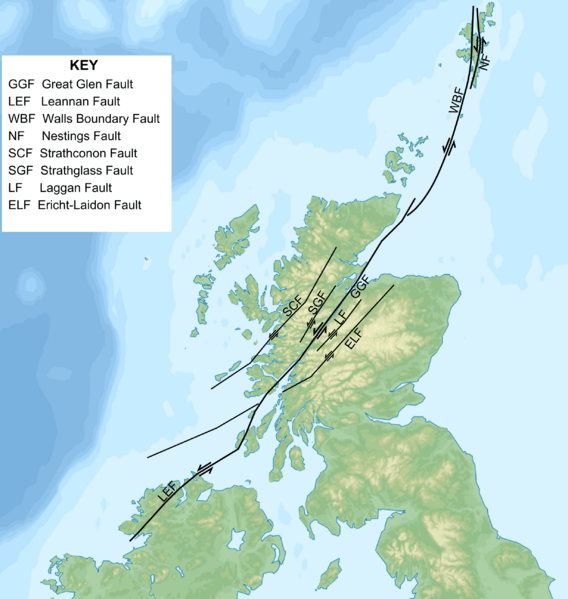
Description: Map of Late Caledonian sinistral strike-slip faults in Scotland and the northern part of the island of Ireland, based on various published maps. Base map is a cropped version of File:Blank topographic map of the British Isles.svg.
Title: Great Glen Fault map
Credit: Own work
Author: Mikenorton
Usage Terms: Creative Commons Attribution-Share Alike 4.0
License: CC BY-SA 4.0
License Link: https://creativecommons.org/licenses/by-sa/4.0
Attribution Required?: Yes
Image usage
There are no pages that link to this image.

All content from Kiddle encyclopedia articles (including the article images and facts) can be freely used under Attribution-ShareAlike license, unless stated otherwise.