
Image: GreaterLAmap

Size of this preview: 600 × 600 pixels. Other resolutions: 240 × 240 pixels | 1,000 × 1,000 pixels.
Original image (1,000 × 1,000 pixels, file size: 621 KB, MIME type: image/png)
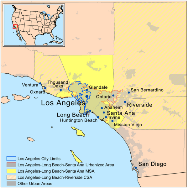
Description: A map of the Greater Los Angeles Area in Southern California. The light gray shading indicates urbanized areas with Greater Los Angeles as defined by urbanized areas outlined in red. The Metropolitan Statistical Area is shown in yellow. The Combined Statistical Area includes the MSA plus those counties that are partially shaded.
Title: GreaterLAmap
Credit: Self-made, based on U.S. Census Bureau data.
Author: Kmusser
Usage Terms: Creative Commons Attribution-Share Alike 3.0
License: CC BY-SA 3.0
License Link: http://creativecommons.org/licenses/by-sa/3.0
Attribution Required?: Yes
Image usage
The following page links to this image:

All content from Kiddle encyclopedia articles (including the article images and facts) can be freely used under Attribution-ShareAlike license, unless stated otherwise.