
Image: Greater Syria Map
Size of this preview: 800 × 480 pixels. Other resolutions: 320 × 192 pixels | 1,000 × 600 pixels.
Original image (1,000 × 600 pixels, file size: 50 KB, MIME type: image/png)
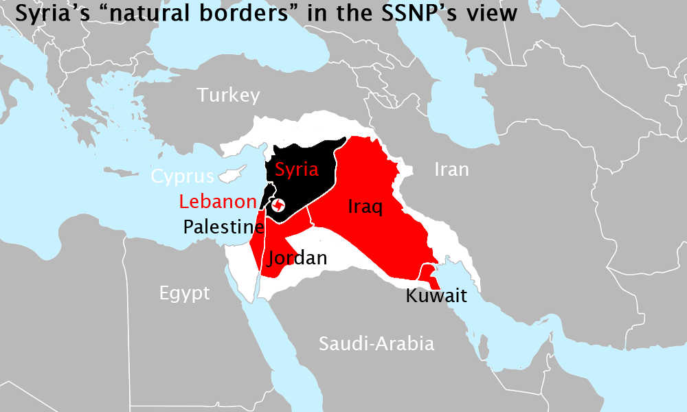
Description: simplification of the "General map of natural Syria" seen on the website of Homs' SSNP branch (Syrian Social Nationalist Party) black - Syria and Lebanon red - other countries of the "Fertile Crescent" (Jordan, Palestine, Iraq with Kuwait) white - claimed terrorities from other neighboured states (Turkey, Iran, Saudi-Arabia, Egypt, Cyprus)
Title: Greater Syria Map
Credit: based on الخريطة العامة لسورية الطبيعية
Author: User:Roxanna
Usage Terms: Creative Commons Attribution 3.0
License: CC BY 3.0
License Link: https://creativecommons.org/licenses/by/3.0
Attribution Required?: Yes
Image usage
The following page links to this image:

All content from Kiddle encyclopedia articles (including the article images and facts) can be freely used under Attribution-ShareAlike license, unless stated otherwise.