
Image: Greaterboston2
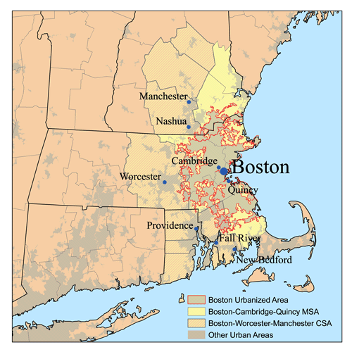
Description: This is a map of the Greater Boston Metro area I made using U.S. Census Bureau data as of 2006. The light gray shading indicates urbanized areas with Greater Boston as defined by urbanized areas outlined in red. The Metropolitan Statistical Area is shown in yellow. The Combined Statistical Area includes the MSA plus those counties that are partially shaded. The Providence metro area was added to the Boston CSA in 2005.
Title: Greaterboston2
Credit: No machine-readable source provided. Own work assumed (based on copyright claims).
Author: No machine-readable author provided. Kmusser assumed (based on copyright claims).
Usage Terms: Creative Commons Attribution-Share Alike 2.5
License: CC BY-SA 2.5
License Link: http://creativecommons.org/licenses/by-sa/2.5
Attribution Required?: Yes
Image usage
There are no pages that link to this image.
