
Image: Greenala Point - geograph.org.uk - 1570878
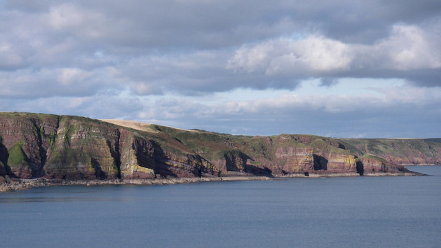
Description: Greenala Point This view north from cliffs south of Stackpole Quay (SR 993 956) shows the coastline extending c. 1km west of Greenala Point (near right hand edge of photo). These cliffs are part of a Site of Special Scientific Interest (SSSI) extending from Stackpole Quay to Freshwater East. The cliffs and coastal slopes have been purchased by the National Trust as part of their 'Project Neptune' conservation programme. The Pembrokeshire coastline was designated as a National Park in 1952, and the coast path is a National Trail. This national park is the only one in the UK that is predominantly coastal. The ?Iron Age promontory fort at Greenala Point is a Scheduled Ancient Monument (SAM) Some detail on the geology is provided in my other Geograph photos of this coastline.
Title: Greenala Point - geograph.org.uk - 1570878
Credit: From geograph.org.uk
Author: Sid Howells
Usage Terms: Creative Commons Attribution-Share Alike 2.0
License: CC BY-SA 2.0
License Link: https://creativecommons.org/licenses/by-sa/2.0
Attribution Required?: Yes
Image usage
The following page links to this image:
