
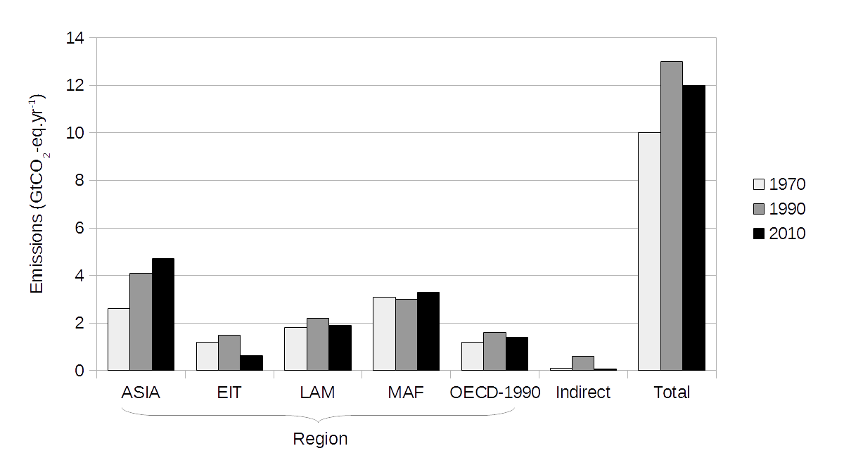
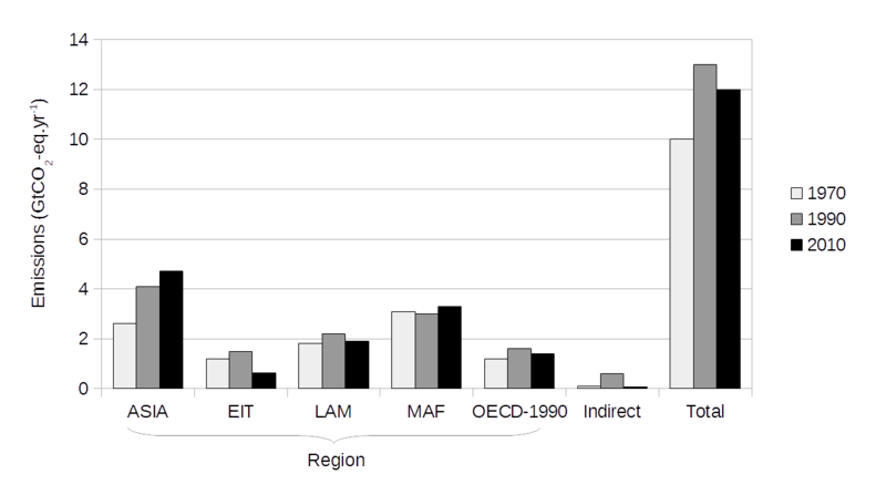
Image: Greenhouse gas emissions from agriculture, forestry and other land use, 1970-2010
Description: This graph shows greenhouse gas emissions from agriculture, forestry and other land use, covering the years 1970, 1990 and 2010. Emissions are measured in units of billion (109) tonnes of carbon dioxide-equivalent per year. Emissions are assigned to the following regions (see notes for full details): ASIA: Non-OECD Asia EIT: Economies in Transition, made up of Eastern Europe and part of the former Soviet Union LAM: Latin America and Caribbean MAF: Africa and Middle East OECD-1990: OECD countries in 1990 Indirect and total emissions are also shown. Data are tabulated in a later section. Notes Data are from the following source: Figure 11.2, in: Chapter 11: Agriculture, Forestry and Other Land Use (AFOLU), in: IPCC AR5 WG3; Edenhofer, O., et al., ed. (2014). Climate Change 2014: Mitigation of Climate Change. Contribution of Working Group III (WG3) to the Fifth Assessment Report (AR5) of the Intergovernmental Panel on Climate Change (IPCC). Cambridge University Press.. Archived 29 June 2014. Details on regional aggregations are given in: A.II.2 Region Definitions, in: Annex II: Metrics and Methodology, in: IPCC AR5 WG3.
Title: Greenhouse gas emissions from agriculture, forestry and other land use, 1970-2010
Credit: Own work
Author: Enescot
Usage Terms: Creative Commons Zero, Public Domain Dedication
License: CC0
License Link: http://creativecommons.org/publicdomain/zero/1.0/deed.en
Attribution Required?: No
Image usage
There are no pages that link to this image.
