
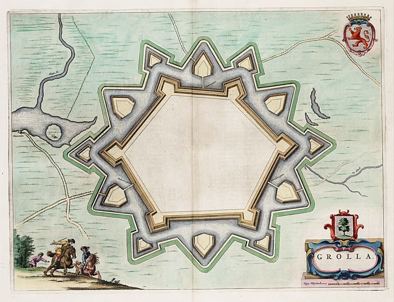
Image: Grolla - Map of Groenlo, after 1628 (J.Blaeu, 1649)

Size of this preview: 783 × 599 pixels. Other resolutions: 314 × 240 pixels | 5,500 × 4,211 pixels.
Original image (5,500 × 4,211 pixels, file size: 2.7 MB, MIME type: image/jpeg)
Description: Map of the defensive works of Grolla (Groenlo) - the Netherlands, after the restaurations made in 1628. Map found in the Theater of Cities of 1649.
Title: Grolla - Map of Groenlo, after 1628 (J.Blaeu, 1649)
Credit: Toonneel der Steeden van de vereenighde Nederlanden
Author: J.Blaeu
Permission: Public Domain
Usage Terms: Public domain
License: Public domain
Attribution Required?: No
Image usage
The following page links to this image:

All content from Kiddle encyclopedia articles (including the article images and facts) can be freely used under Attribution-ShareAlike license, unless stated otherwise.
.jpg)