
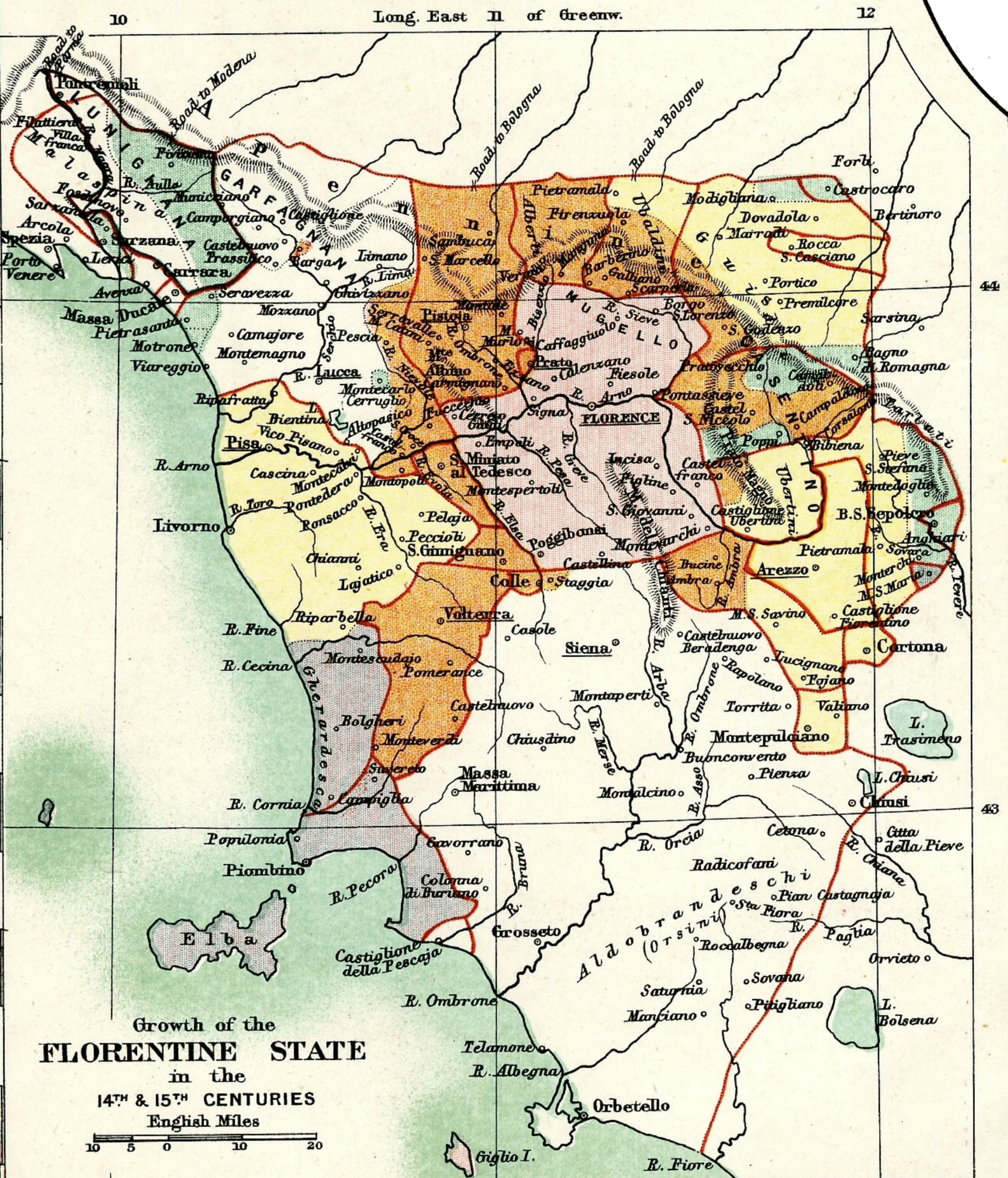
Image: Growth of the Florentine State
Description: The "Growth of the Florentine State in the 14th & 15th Centuries", an inset map from Plate 68 in Reginald Lane Poole's Historical Atlas of Modern Europe. The boundaries of the Tuscan states in 1300 are distinguished by scarlet borders. The Florentine state in 1300 is colored pink. Its expansion up to 1377 is brown, but areas gained and lost before 1377 have only a brown border. Further expansion up to 1433 is colored yellow; further expansion up to 1494, green. Territory raccomodato to Florence but never under complete subjection is colored violet, while territory raccomodato to Florence and lost again before 1500 has only a violet border.
Title: Growth of the Florentine State
Credit: From File:Italy 1454 after the Peace of Lodi.jpg
Author: Reginald Lane Poole; LlywelynII
Usage Terms: Public domain
License: Public domain
Attribution Required?: No
Image usage
The following page links to this image:
