
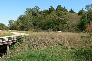
Image: Guide Rock (Pa-hur) from W 2

Size of this preview: 800 × 531 pixels. Other resolutions: 320 × 212 pixels | 2,392 × 1,588 pixels.
Original image (2,392 × 1,588 pixels, file size: 1.72 MB, MIME type: image/jpeg)
Description: Pa-hur, a.k.a. Guide Rock: a hill on the south side of the Republican River, southeast of Guide Rock, Nebraska. Seen from the west. The bridge in the left foreground crosses Rankin Creek.
Title: Guide Rock (Pa-hur) from W 2
Credit: Own work
Author: Ammodramus
Usage Terms: Public domain
License: Public domain
Attribution Required?: No
Image usage
The following page links to this image:

All content from Kiddle encyclopedia articles (including the article images and facts) can be freely used under Attribution-ShareAlike license, unless stated otherwise.
_from_W_2.JPG)