
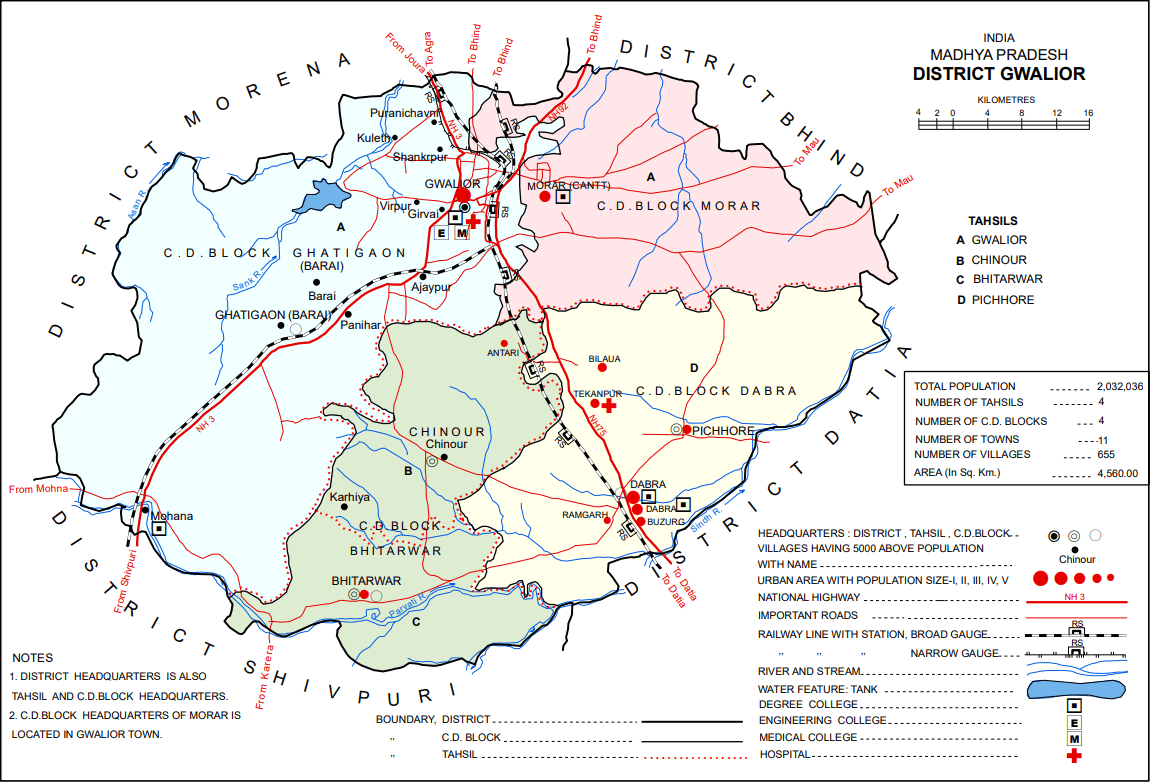
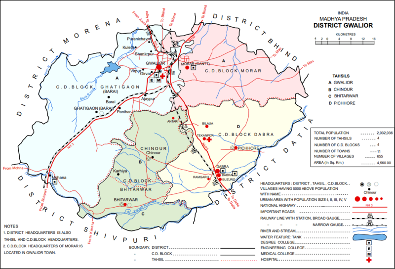
Image: Gwalior district map
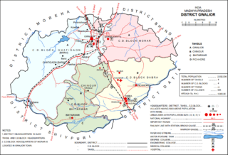
Size of this preview: 800 × 544 pixels. Other resolutions: 320 × 218 pixels | 1,150 × 782 pixels.
Original image (1,150 × 782 pixels, file size: 113 KB, MIME type: image/png)
Description: Map of Gwalior district subdivisions, originally from the 2011 Census district handbook for Madhya Pradesh.
Title: Gwalior district map
Credit: https://www.censusindia.gov.in/2011census/dchb/DCHB_A/23/2304_PART_A_DCHB_GWALIOR.pdf
Author: Rajendra Kumar, Vinod Kumar Singh, Meena Shinde, J.U. Gobdole, Rajendra Gumdelwar, Manoj Prabhakar Manik, and Jitendra Singh Verma
Usage Terms: Government Open Data License – India
License: GODL-India
License Link: https://data.gov.in/sites/default/files/Gazette_Notification_OGDL.pdf
Attribution Required?: Yes
Image usage
The following page links to this image:

All content from Kiddle encyclopedia articles (including the article images and facts) can be freely used under Attribution-ShareAlike license, unless stated otherwise.