
Image: HABS-Tudor-Place-South-Elevation-Measured-Drawing-1999

Size of this preview: 748 × 600 pixels. Other resolutions: 299 × 240 pixels | 7,484 × 6,000 pixels.
Original image (7,484 × 6,000 pixels, file size: 3.47 MB, MIME type: image/jpeg)
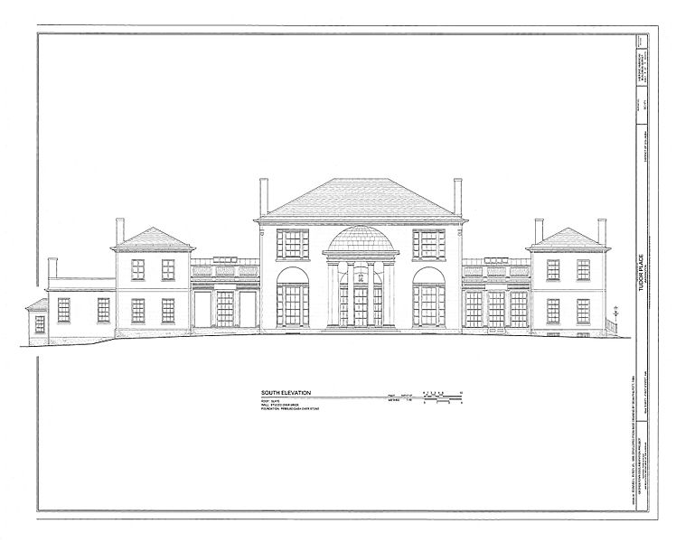
Description: Historic American Buildings Survey measured drawing of the South Elevation of Tudor Place prepared at a scsale of 1:48 in 1999. Survey No.DC 171
Title: HABS-Tudor-Place-South-Elevation-Measured-Drawing-1999
Credit: https://www.loc.gov/resource/hhh.dc0257.sheet/?sp=3
Author: Edward L Byrdy Jnr, Dean Philpott RIBA
Usage Terms: Creative Commons Zero, Public Domain Dedication
License: CC0
License Link: http://creativecommons.org/publicdomain/zero/1.0/deed.en
Attribution Required?: No
Image usage
The following page links to this image:

All content from Kiddle encyclopedia articles (including the article images and facts) can be freely used under Attribution-ShareAlike license, unless stated otherwise.