
Image: HMSO Graf Spee map of River Plate
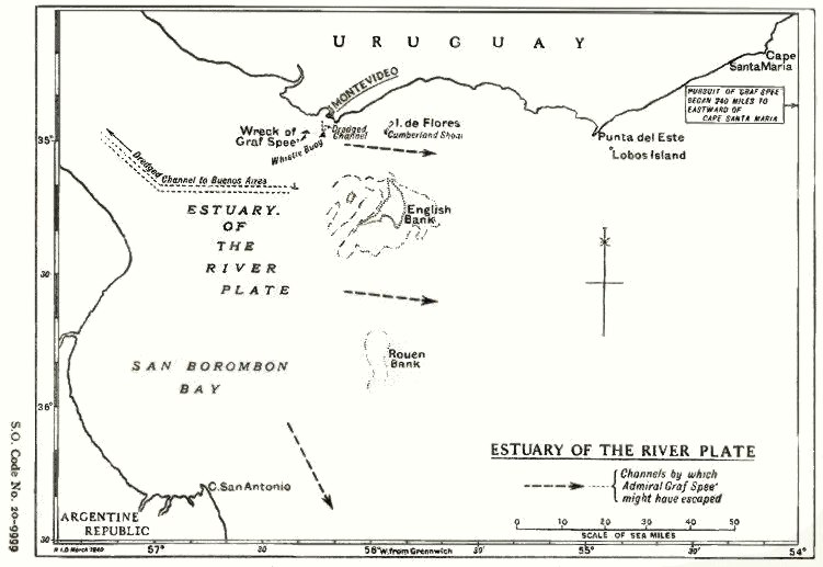
Description: Map of the estuary of the River Plate showing possible exit channels available to the German heavy cruiser Admiral Graf Spee after the Battle of the River Plate in December 1939.
Title: HMSO Graf Spee map of River Plate
Credit: From official British report into the cruise of the Graf Spee and Battle of the River Plate. Published by HMSO (His Majesty's Stationery Office). Originally uploaded to EN Wikipedia as en:File:HMSO Graf Spee map of River Plate.jpg by en:User:Duncharris 26 December 2004; modified by en:User:Lhgodoy 22 March 2006.
Author: British Government
Permission: This work created by the United Kingdom Government is in the public domain. This is because it is one of the following: It is a photograph taken prior to 1 June 1957; or It was published prior to 1973; or It is an artistic work other than a photograph or engraving (e.g. a painting) which was created prior to 1973.HMSO has declared that the expiry of Crown Copyrights applies worldwide (ref: HMSO Email Reply) More information. See also Copyright and Crown copyright artistic works.
Usage Terms: Public domain
License: Public domain
Attribution Required?: No
Image usage
The following page links to this image:
