
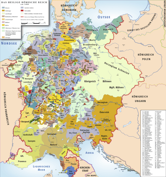
Image: HRR 1400

Size of this preview: 562 × 600 pixels. Other resolutions: 225 × 240 pixels | 3,715 × 3,966 pixels.
Original image (3,715 × 3,966 pixels, file size: 3.71 MB, MIME type: image/png)
Description: Map of Holy Roman Empire 1400
Title: HRR 1400
Credit: own drawing/Source of Information: Putzger – Historischer Weltatlas, 89. Auflage, 1965; Westermanns Großer Atlas zur Weltgeschichte, 1969; Haacks geographischer Atlas. VEB Hermann Haack Geographisch-Kartographische Anstalt, Gotha/Leipzig, 1. Auflage, 1979; dtv-Atlas zur Weltgeschichte 1. Von den Anfängen bis zur Französischen Revolution; 23. Aufl. 1989, ISBN 3-423-03001-1
Author: Ziegelbrenner
Permission: s.u.
Usage Terms: Creative Commons Attribution 2.5
License: CC BY 2.5
License Link: http://creativecommons.org/licenses/by/2.5
Attribution Required?: Yes
Image usage
The following page links to this image:

All content from Kiddle encyclopedia articles (including the article images and facts) can be freely used under Attribution-ShareAlike license, unless stated otherwise.