
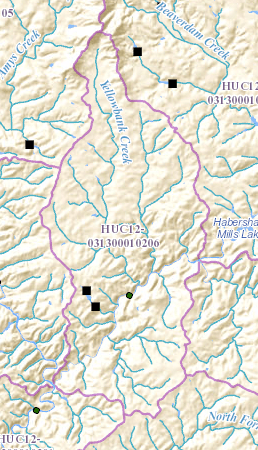
Image: HUC 031300010206 - Yellowbank Creek-Lower Soque River
No higher resolution available.
HUC_031300010206_-_Yellowbank_Creek-Lower_Soque_River.PNG (258 × 450 pixels, file size: 262 KB, MIME type: image/png)
Description: HUC 031300010206 - Yellowbank Creek-Lower Soque River. Map shows Yellowbank Creek flowing from north to south, joining the Soque River, which bisects the sub-watershed from east to southwest.
Title: HUC 031300010206 - Yellowbank Creek-Lower Soque River
Credit: http://viewer.nationalmap.gov/viewer/nhd.html?p=nhd&b=base1&q=031300010206&x=-9304717.22793678&y=4108937.979791637&l=12&v=
Author: USGS
Usage Terms: Public domain
License: Public domain
Attribution Required?: No
Image usage
The following page links to this image:

All content from Kiddle encyclopedia articles (including the article images and facts) can be freely used under Attribution-ShareAlike license, unless stated otherwise.