
Image: Hadrian's Wall map, Wallsend Metro station - geograph.org.uk - 725591
No higher resolution available.
Hadrian's_Wall_map,_Wallsend_Metro_station_-_geograph.org.uk_-_725591.jpg (640 × 447 pixels, file size: 67 KB, MIME type: image/jpeg)
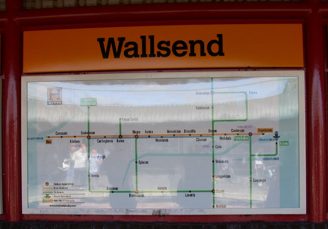
Description: Hadrian's Wall map, Wallsend Metro station The H MVRVS schematic imitates the style of the those used by the M METRO. The "stations" marked are Maia, Concauata, Aballava, Uxelodunum, Camboglanna, Banna, Magna, Aesica, Vindolanda, Verovicium, Brocolitia, Cilumum, Onnum, Vindobala, Condercum, Pons Aelius and Segedunum. Artwork by Michael Pinsky.
Title: Hadrian's Wall map, Wallsend Metro station - geograph.org.uk - 725591
Credit: From geograph.org.uk
Author: Keith Edkins
Usage Terms: Creative Commons Attribution-Share Alike 2.0
License: CC BY-SA 2.0
License Link: http://creativecommons.org/licenses/by-sa/2.0
Attribution Required?: Yes
Image usage
The following page links to this image:

All content from Kiddle encyclopedia articles (including the article images and facts) can be freely used under Attribution-ShareAlike license, unless stated otherwise.