
Image: Hamburg Sturmflut 1962
Size of this preview: 800 × 418 pixels. Other resolutions: 320 × 167 pixels | 5,349 × 2,796 pixels.
Original image (5,349 × 2,796 pixels, file size: 5.51 MB, MIME type: image/png)
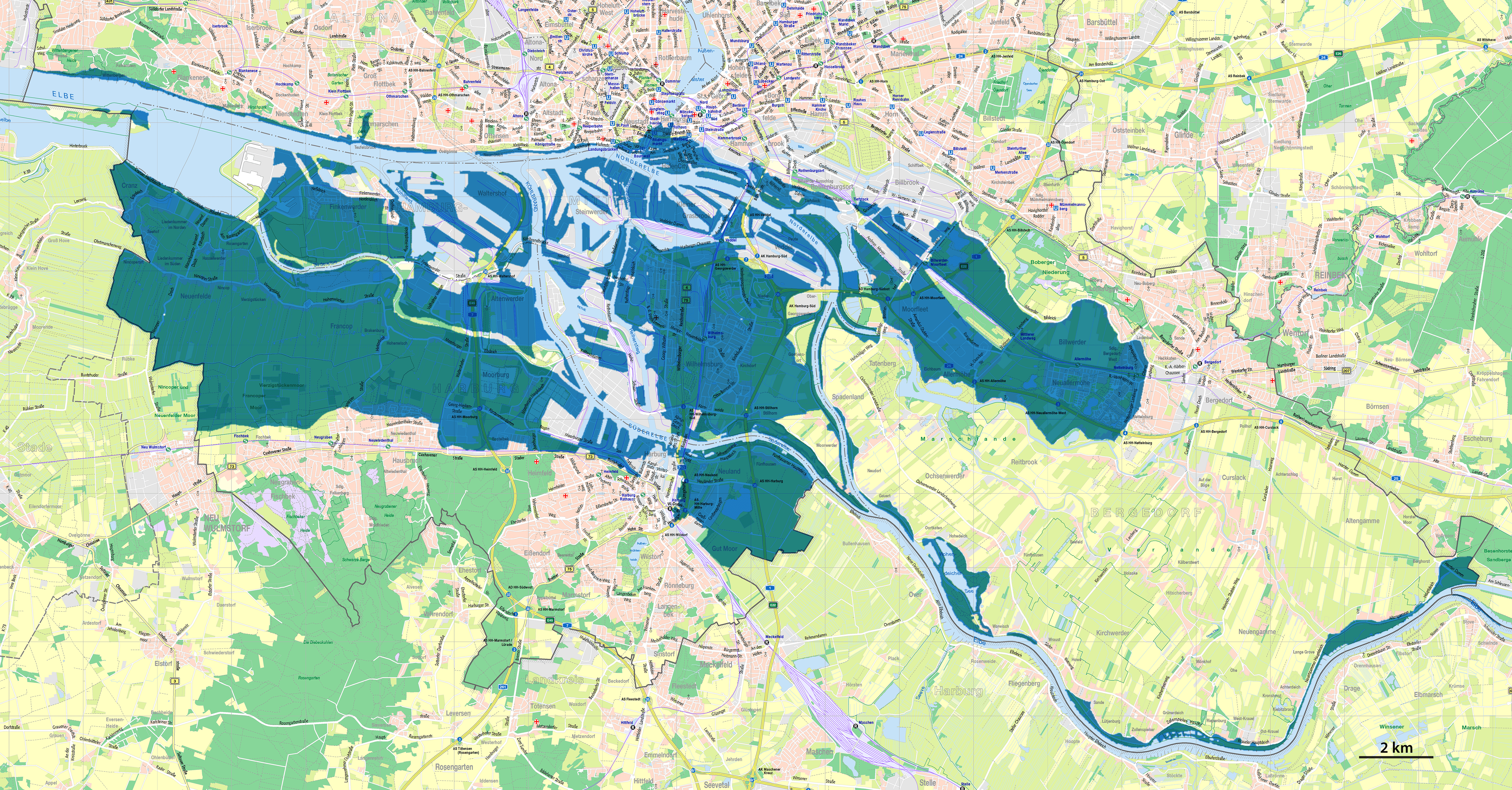
Description: Map of the flooded areas of Hamburg during the North Sea flood of 1962
Title: Hamburg Sturmflut 1962
Credit: Own work using: Digitale Stadtkarte 1: 60.000 Hamburg by Freie und Hansestadt Hamburg, Landesbetrieb Geoinformation und Vermessung, 2014 http://www.hamburg.de/sturmflut-1962/
Author: NordNordWest
Usage Terms: Data licence Germany – attribution – Version 2.0
License: dl-de/by-2-0
License Link: https://www.govdata.de/dl-de/by-2-0
Attribution Required?: Yes
Image usage
The following page links to this image:

All content from Kiddle encyclopedia articles (including the article images and facts) can be freely used under Attribution-ShareAlike license, unless stated otherwise.