
Image: Hampton 1978 001c
No higher resolution available.
Hampton_1978_001c.JPG (672 × 484 pixels, file size: 47 KB, MIME type: image/jpeg)
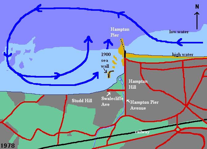
Description: Hand-drawn map of the erstwhile site and later 1978 surroundings of the drowned coastal village Hampton-on-Sea, Herne Bay, Kent, England. Based on 1978 OS map. The map was drawn to illustrate the theory that the cause of the erosion which destroyed Hampton-on-Sea could be an eddy initiated by the existence of the pier and the adjacent coastal formation.
Title: Hampton 1978 001c
Credit: Own work
Author: Storye book
Usage Terms: Creative Commons Attribution 3.0
License: CC BY 3.0
License Link: https://creativecommons.org/licenses/by/3.0
Attribution Required?: Yes
Image usage
The following page links to this image:

All content from Kiddle encyclopedia articles (including the article images and facts) can be freely used under Attribution-ShareAlike license, unless stated otherwise.