
Image: Han map
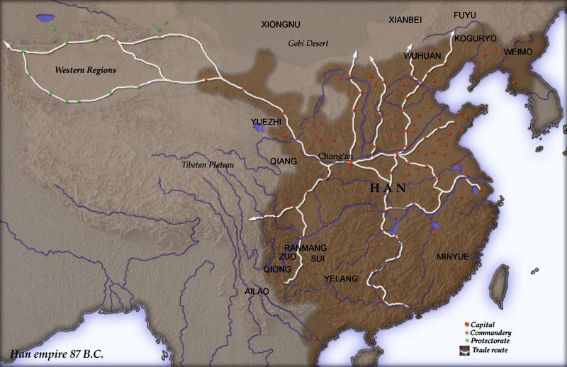
Description: Map of en:Han Dynasty empire 87 BC, showing the capital en:Chang'an and the location of all en:commandery seats. In the Western Regions, a number of pretectorates were Han vassals and under the nominal authority of the Chief Protector of the Western Regions appointed by the Han court. en:Category:Maps of the history of China
Title: Han map
Credit: Created and copyright (2004) by Yuninjie. Released under the GNU FDL. The northern border is the line of the en:Qin Dynasty en:Great Wall. Trade routes are generally based on the work of en:Joseph Needham. Selected non-Chinese peoples are also shown.
Author: User Yuninjie on en.wikipedia
Permission: Released under the GNU Free Documentation License.
Usage Terms: Creative Commons Attribution-Share Alike 3.0
License: CC-BY-SA-3.0
License Link: http://creativecommons.org/licenses/by-sa/3.0/
Attribution Required?: Yes
Image usage
The following page links to this image:
