
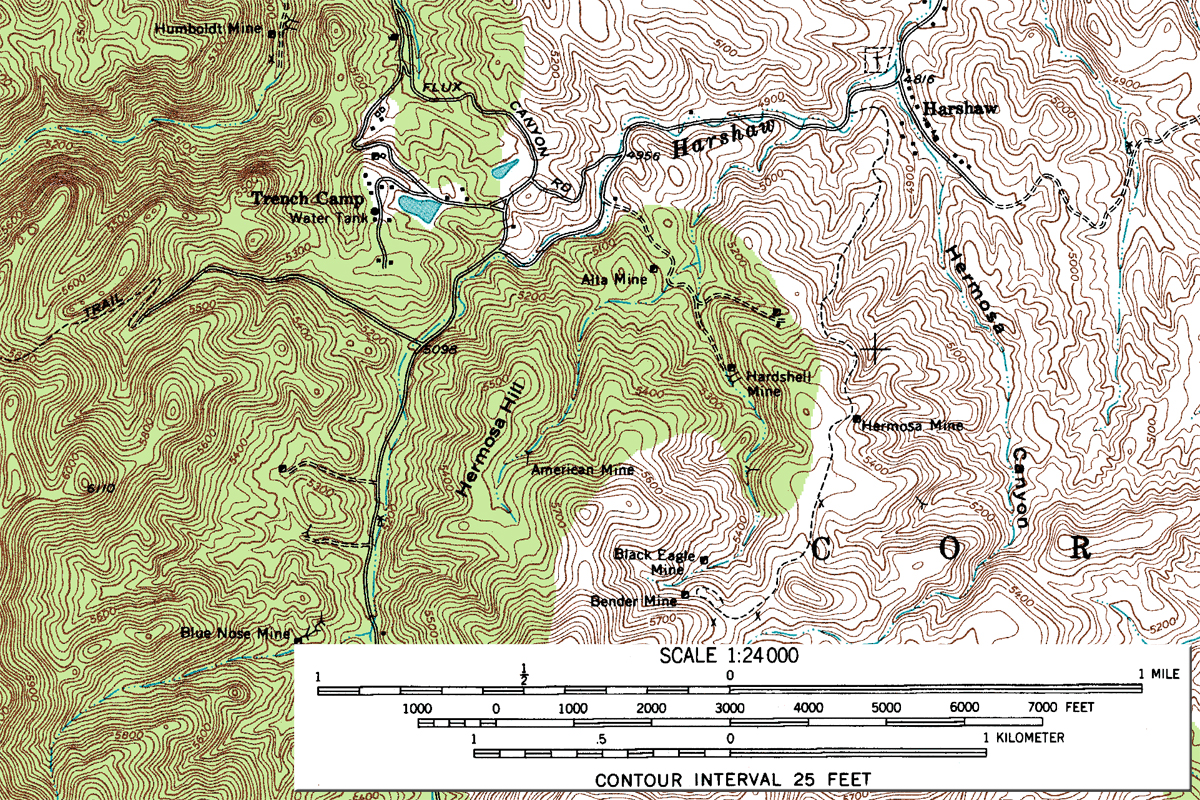
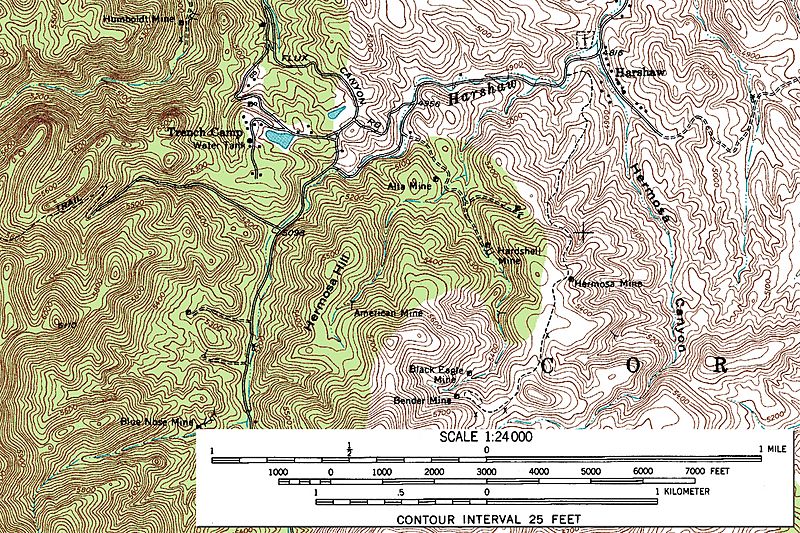
Image: Harshaw Area USGS Topographical Map
Size of this preview: 800 × 533 pixels. Other resolutions: 320 × 213 pixels | 1,200 × 800 pixels.
Original image (1,200 × 800 pixels, file size: 1.62 MB, MIME type: image/jpeg)
Description: Harshaw Area - Segment of Topographic Map, Harshaw Quadrangle, Arizona, Santa Cruz County. 7.5 minute series. USGS 1958.
Title: Harshaw Area USGS Topographical Map
Credit: USGS (see full map at File:Harshaw Quadrangle USGS Topographical Map.gif for more details).
Author: United States Geological Survey (USGS)
Permission: Public domain
Usage Terms: Public domain
License: Public domain
Attribution Required?: No
Image usage
The following page links to this image:

All content from Kiddle encyclopedia articles (including the article images and facts) can be freely used under Attribution-ShareAlike license, unless stated otherwise.