
Image: Hertfordshire Administrative Map 1832

Size of this preview: 756 × 600 pixels. Other resolutions: 303 × 240 pixels | 2,000 × 1,587 pixels.
Original image (2,000 × 1,587 pixels, file size: 145 KB, MIME type: image/png)
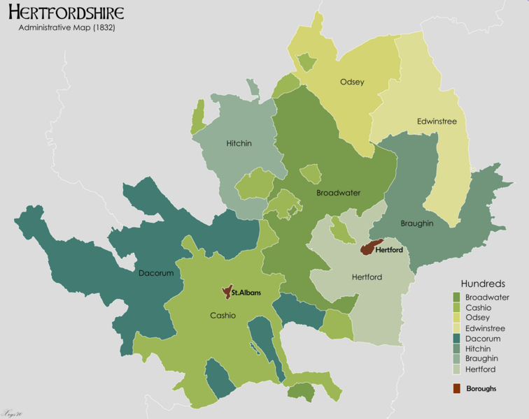
Description: Administrative map of the ancient county of Hertfordshire in 1832. Showing Hundreds and Boroughs. Source data on parish boundaries - Kain, R.J.P., and Oliver, R.R. (2001) "Historic parishes of England and Wales: Electronic Map - Gazetteer - Metadata", Colchester: History Data Service. ISBN 0 9540032 0 9. Source data for Boroughs: H.M.S.O. Boundary Commission Report 1832 (courtesy of www.visionofbritain.org).
Title: Hertfordshire Administrative Map 1832
Credit: Own work
Author: XrysD
Usage Terms: Creative Commons Attribution-Share Alike 3.0
License: CC BY-SA 3.0
License Link: https://creativecommons.org/licenses/by-sa/3.0
Attribution Required?: Yes
Image usage
The following page links to this image:

All content from Kiddle encyclopedia articles (including the article images and facts) can be freely used under Attribution-ShareAlike license, unless stated otherwise.