
Image: Heth Moves - Battle of Lewisburg
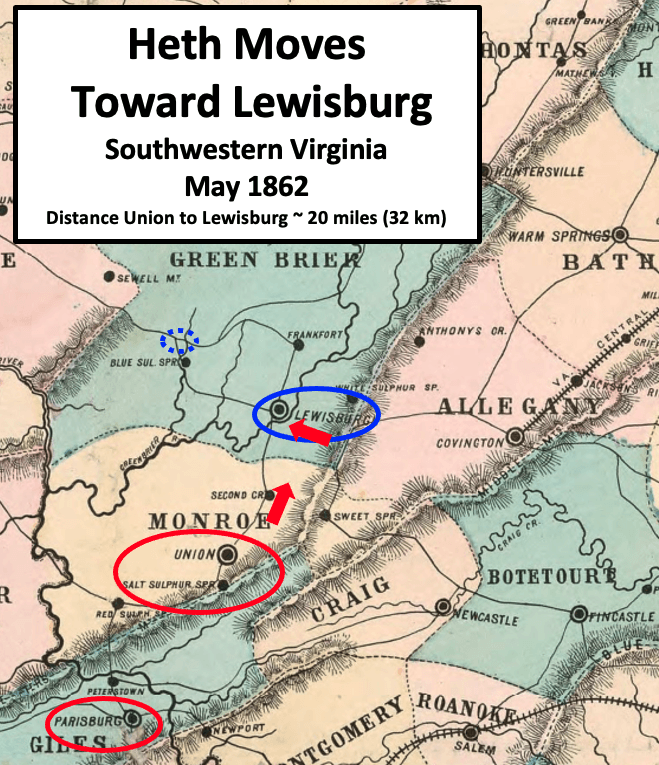
Description: Map describes the situation in May 1862 in southwestern Virginia during the American Civil War. After a victory a Pearisburg (also spelled Parisburg), Heth moved north through Salt Sulphur Springs and Union to an eastern entrance to Lewisburg. This involved crossing a bridge on the Greenbrier River near present-day Caldwell, West Virginia.
Title: Heth Moves - Battle of Lewisburg
Credit: This is a crop of an 1861 map created by O.N. Snow & Co. The entire map can be found in the Library of Congress here, and shows Virginia, Delaware, Maryland & West Virginia. Text box, circles, and arrows were added by TwoScarsUp based on descriptions in the book "The Battle of Lewisburg" by Richard L. Armstrong, chapter 5.
Author: O.N. Snow with modifications by TwoScarsUp
Usage Terms: Public domain
License: Public domain
Attribution Required?: No
Image usage
The following page links to this image:
