
Image: High Peak UK location map

Size of this PNG preview of this SVG file: 460 × 599 pixels. Other resolution: 184 × 240 pixels.
Original image (SVG file, nominally 801 × 1,043 pixels, file size: 1.46 MB)
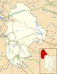
Description: Location map of the Borough of High Peak with the following information shown: Motorways Primary routes Non-primary A roads B roads Railways Water Woodland Buildings Equirectangular map projection on WGS 84 datum, with N/S stretched 160%
Title: High Peak UK location map
Credit: Ordnance Survey OpenData.
Author: Rcsprinter123
Usage Terms: Creative Commons Attribution 3.0
License: CC BY 3.0
License Link: https://creativecommons.org/licenses/by/3.0
Attribution Required?: Yes
Image usage
The following page links to this image:

All content from Kiddle encyclopedia articles (including the article images and facts) can be freely used under Attribution-ShareAlike license, unless stated otherwise.