
Image: Hittite Kingdom

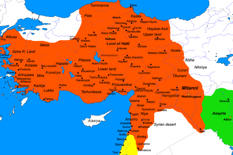
Description: Map of the Hittite Empire at its greatest extent under Suppiluliuma I(c.1350–1322) and Mursili II (c.1321–1295). Because many of the place names have been taken from Hittite sources and compared to classical place names, they may not all be correct as there is still scholarly disagreement (ex. Lukka as Lycia, Karkija as Caria).
Title: Hittite Kingdom
Credit: I (Javierfv1212 (talk)) created this work entirely by myself. Historical sources: Byrce, Trevor, "The Kingdom of the Hittites". Oxford university press, 2005. http://www.utexas.edu/courses/classicalarch/images1/Hittiterulemap.jpg http://www.thelatinlibrary.com/imperialism/maps/hittites.gif http://hittites.info/map.aspx#DisplayMap
Author: Javierfv1212 (talk)
Usage Terms: Public domain
License: Public domain
Attribution Required?: No
Image usage
The following page links to this image:
