
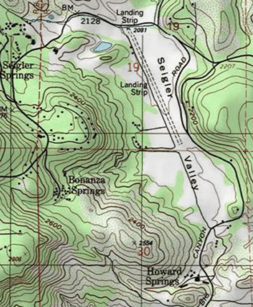
Image: Howard Springs, CA USGS topo map

Size of this preview: 493 × 600 pixels. Other resolutions: 197 × 240 pixels | 518 × 630 pixels.
Original image (518 × 630 pixels, file size: 262 KB, MIME type: image/png)
Description: Howard Springs, Lake County, California. Resort in lower left, south of Seigler Valley
Title: Howard Springs, CA USGS topo map
Credit: https://geonames.usgs.gov/apex/gazvector.getesrimap?p_lat=39.1623904&p_longi=-122.6122081&fid=261564
Author: USGS
Usage Terms: Public domain
License: Public domain
Attribution Required?: No
Image usage
The following page links to this image:

All content from Kiddle encyclopedia articles (including the article images and facts) can be freely used under Attribution-ShareAlike license, unless stated otherwise.