
Image: Hurricane Karl 21 sept 2004 1315Z
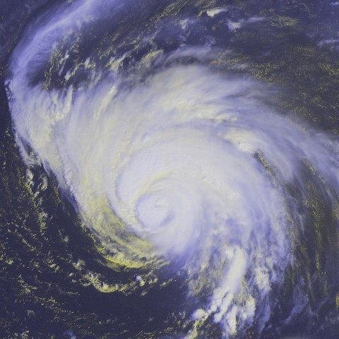
Description: Taken from GOES-12 satellite. Hurricane Karl in the Atlantic Ocean on September 21, 2004. As of 11 AST, Karl was about 1005 miles (1620 km) ENE of the Northern Leeward Islands with sustained winds of 140 mph (225 kph)
Title: Hurricane Karl 21 sept 2004 1315Z
Credit: http://www.osei.noaa.gov/Events/Tropical/Atlantic/2004/TRCjeanne-karl265_G12.jpg
Author: NOAA / Operational Significant Event Imagery
Permission: This image is in the public domain because it contains materials that originally came from the U.S. National Oceanic and Atmospheric Administration, taken or made as part of an employee's official duties. Čeština | Deutsch | Zazaki | English | Español | Eesti | Suomi | Français | Magyar | Italiano | 日本語 | 한국어 | Македонски | മലയാളം | Plattdüütsch | Nederlands | Polski | Português | Română | Русский | Sicilianu | Slovenščina | Türkçe | 中文 | 中文(简体) | +/− The NOAA emblem is the property of the U.S. Government and a trademark of the United States Department of Commerce.
Usage Terms: Public domain
License: Public domain
Attribution Required?: No
Image usage
The following page links to this image:
