
Image: Hyderabad princely state 1909

Size of this PNG preview of this SVG file: 683 × 599 pixels. Other resolution: 274 × 240 pixels.
Original image (SVG file, nominally 800 × 702 pixels, file size: 27 KB)
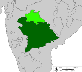
Description: Map of Indian state of Hyderabad in 1909 Legend: ━━━ Princely states borders ▉ Princely states territories ▉ Berar ▉ Hyderabad
Title: Hyderabad princely state 1909
Credit: http://sharemap.org/public/Hyderabad Geospatial data sources: The State in 1903 The State in 1909 2nd map of Hyderabad in 1909
Author: Jkan997
Usage Terms: Creative Commons Attribution-Share Alike 3.0
License: CC BY-SA 3.0
License Link: http://creativecommons.org/licenses/by-sa/3.0
Attribution Required?: Yes
Image usage
There are no pages that link to this image.

All content from Kiddle encyclopedia articles (including the article images and facts) can be freely used under Attribution-ShareAlike license, unless stated otherwise.