
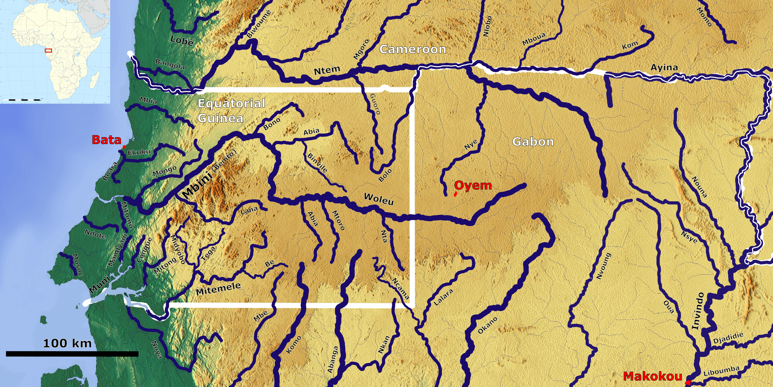
Image: Hydrology of Equatorial Guinea OSM
Size of this preview: 800 × 400 pixels. Other resolutions: 320 × 160 pixels | 2,575 × 1,289 pixels.
Original image (2,575 × 1,289 pixels, file size: 2.21 MB, MIME type: image/png)
Description: The Rivers in and around Equatorial Guinea_OSM, Based up on US Army map NA32
Title: Hydrology of Equatorial Guinea OSM
Credit: https://maps-for-free.com/, https://maps.lib.utexas.edu/maps/imw/, Location map:https://commons.wikimedia.org/wiki/File:Africa_location_map.svg
Author: Hans Braxmeier & Peter in s, Location map:Sting
Usage Terms: Creative Commons Attribution-Share Alike 3.0
License: CC BY-SA 3.0
License Link: https://creativecommons.org/licenses/by-sa/3.0
Attribution Required?: Yes
Image usage
The following page links to this image:

All content from Kiddle encyclopedia articles (including the article images and facts) can be freely used under Attribution-ShareAlike license, unless stated otherwise.