
Image: Hyrcania-Alexanders-gates-map

Size of this PNG preview of this SVG file: 660 × 600 pixels. Other resolution: 264 × 240 pixels.
Original image (SVG file, nominally 732 × 665 pixels, file size: 108 KB)
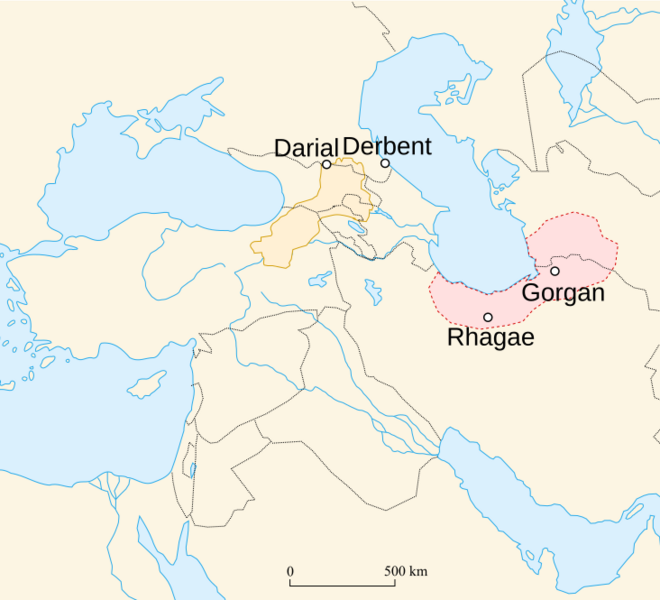
Description: Map showing Hyrcania on area map around region of Caspian Sea and Persia. Circles identify locations of four spots associated with "Alexander's Gates" (Derbent, Dariel, Great Wall of Gorgan, and Rhaegae, Iran).
Author: user:historicair 22:06, 18 August 2007 (UTC); derivative work: user:Kiyoweap
Usage Terms: Creative Commons Attribution-Share Alike 3.0
License: CC-BY-SA-3.0
License Link: http://creativecommons.org/licenses/by-sa/3.0/
Attribution Required?: Yes
Image usage
The following page links to this image:

All content from Kiddle encyclopedia articles (including the article images and facts) can be freely used under Attribution-ShareAlike license, unless stated otherwise.