
Image: ISS-47 Middle East

Size of this preview: 800 × 532 pixels. Other resolutions: 320 × 213 pixels | 4,928 × 3,280 pixels.
Original image (4,928 × 3,280 pixels, file size: 2.02 MB, MIME type: image/jpeg)
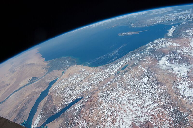
Description: The Middle East is seen from 250 miles above in this photo from the International Space Station. Countries seen left to right along the Mediterranean coast include Egypt, Gaza, Saudi Arabia, Israel, Lebanon, Syria, and Turkey. The major waterways shown from left to right are the Nile River, Gulf of Suez, Gulf of Aqaba, and the Red Sea.
Title: ISS-47 Middle East
Credit: https://www.flickr.com/photos/nasa2explore/26380972471/
Author: NASA
Usage Terms: Public domain
License: Public domain
Attribution Required?: No
Image usage
The following page links to this image:

All content from Kiddle encyclopedia articles (including the article images and facts) can be freely used under Attribution-ShareAlike license, unless stated otherwise.