
Image: ISS View of the Southwestern USA
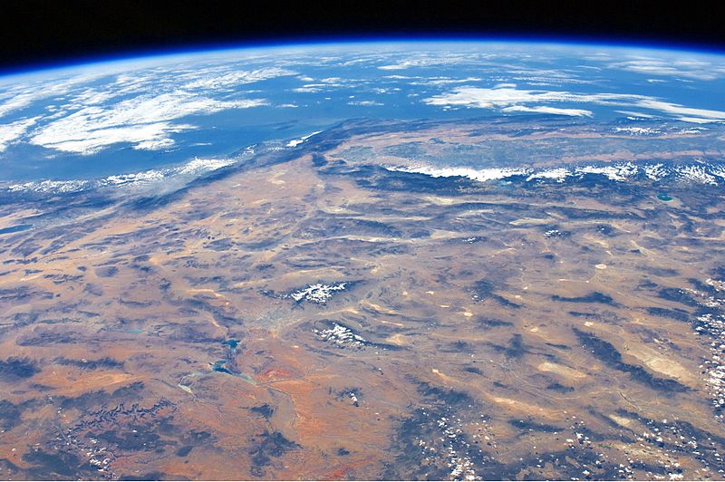
Description: This panoramic view of the south-western United States and Pacific Ocean was taken by an astronaut looking out at an angle from the International Space Station (ISS). The image includes parts of Arizona, Nevada, Utah, and California, as well the coastline of Baja California, Mexico (image centre left). The Las Vegas metropolitan area appears as a gray region adjacent to the Spring Mountains and Sheep Range (both covered by white clouds). The Grand Canyon, located on the Colorado Plateau in Arizona, is visible to the east of Las Vegas, with the blue waters of Lake Mead in between. The image also includes the Mojave Desert, stretching north from the Salton Sea to the Sierra Nevada mountain range. The Sierra Nevada is roughly 640 km long (north-south) and forms the boundary between the Central Valley of California and the adjacent Basin and Range physiographic province. The Basin and Range is so called because of the pattern of long linear valleys separated by parallel mountain ranges. The landscape was formed by extension and thinning of the Earth’s crust.
Title: ISS View of the Southwestern USA
Credit: NASA Earth Observatory
Author: ISS Expedition 24 crew
Usage Terms: Public domain
License: Public domain
Attribution Required?: No
Image usage
The following page links to this image:
