
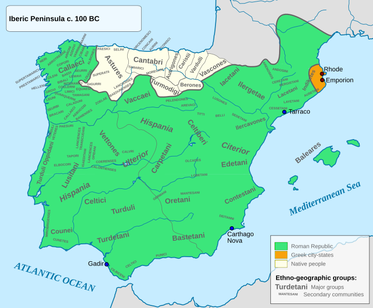
Image: Iberia 100BC

Size of this PNG preview of this SVG file: 727 × 600 pixels. Other resolution: 291 × 240 pixels.
Original image (SVG file, nominally 924 × 762 pixels, file size: 314 KB)
Description: Iberian Peninsula circa 100 BC
Title: Iberia 100BC
Credit: Native groups based on the map done by Portuguese Archeologist Luís Fraga, from the "Campo Arqueológico de Tavira"[1]. Borders based on the Eastern Hemisphere map of year 100 BC[2]. Roman provinces based on the map found at this location [3].
Author: Alcides Pinto
Permission: I, the copyright holder of this work, hereby publish it under the following license:
Usage Terms: GNU Free Documentation License
License: GFDL
License Link: http://www.gnu.org/copyleft/fdl.html
Attribution Required?: Yes
Image usage
The following page links to this image:

All content from Kiddle encyclopedia articles (including the article images and facts) can be freely used under Attribution-ShareAlike license, unless stated otherwise.