
Image: Independence I Battlefield Missouri
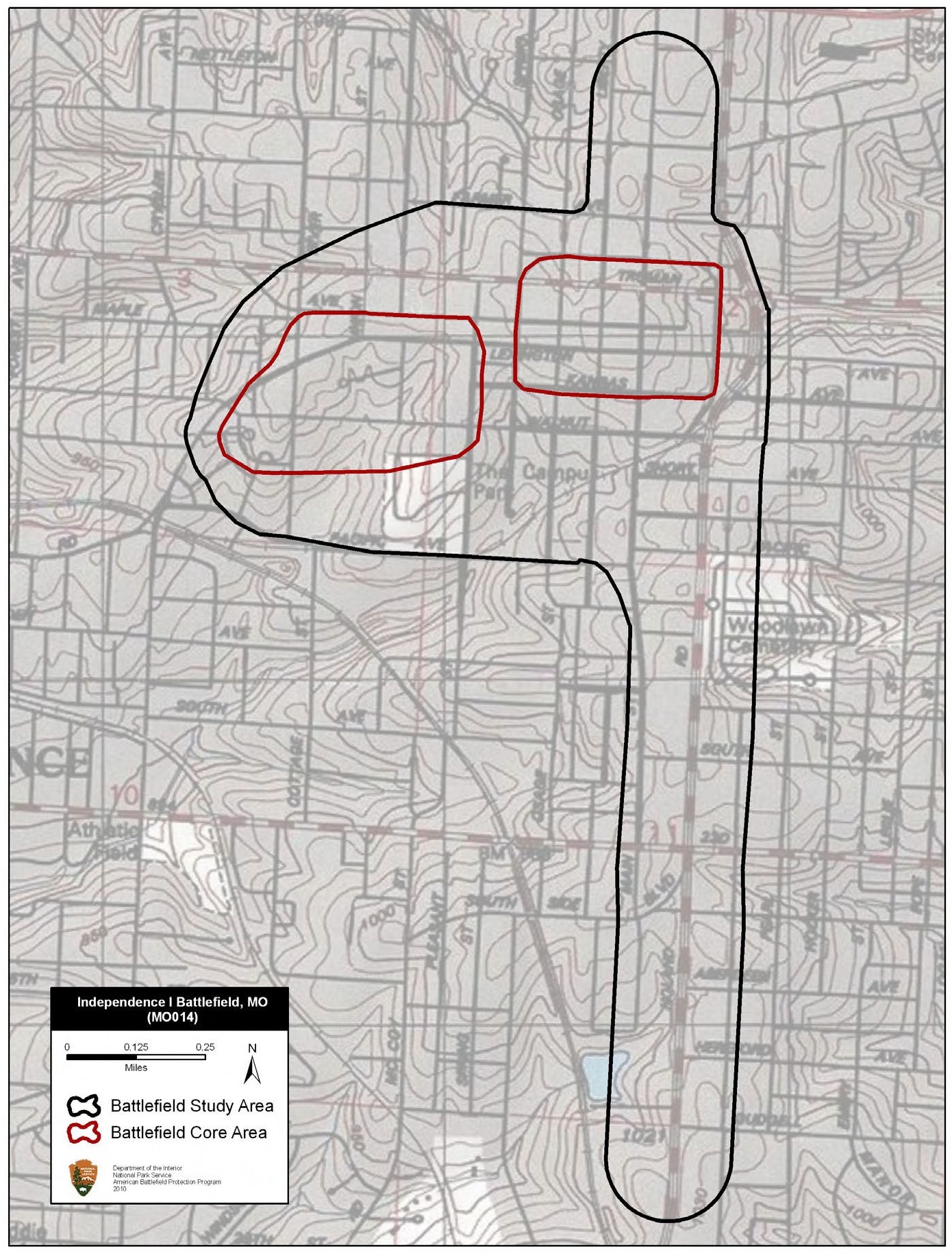
Description: Map of battlefield core and study areas. The ABPP adjusted the 1993 Study Area to more accurately align it with the road used by Confederate forces to approach the center of town (the modern Spring Road), and Walnut Road and Lexington Road, which were used by Confederate forces to attack the Union camp on the western edge of town. The northern Core Area was adjusted to include the locations of fighting around the courthouse square, the bank and barracks buildings used by Federal forces, and the Independence Jail used by the Provost Marshall. The second Core Area represents the location of the Federal camp on the western edge of town that was assaulted by a portion of the Confederate column.
Title: Independence I Battlefield Missouri
Credit: National Park Service
Author: American Battlefield Protection Program
Usage Terms: Public domain
License: Public domain
Attribution Required?: No
Image usage
The following page links to this image:
