
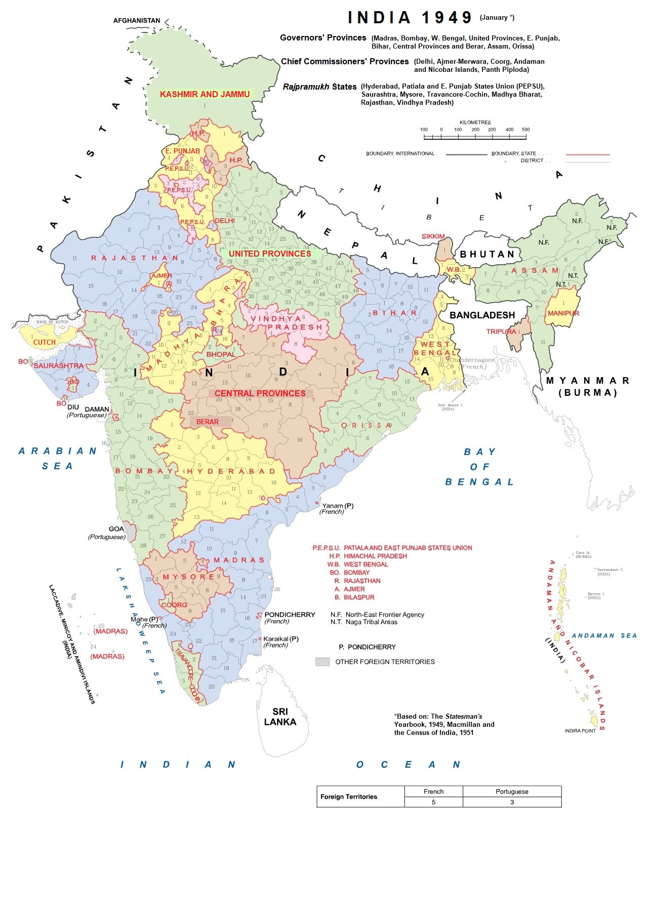
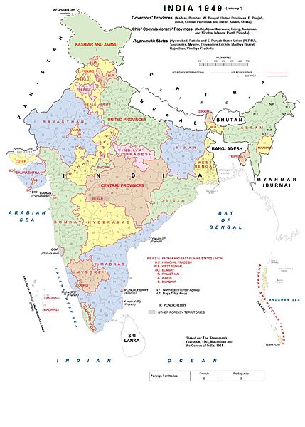
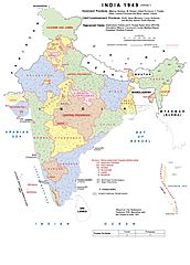
Image: India Administrative Divisions 1949-Kashmir
Size of this preview: 429 × 599 pixels. Other resolutions: 172 × 240 pixels | 1,280 × 1,788 pixels.
Original image (1,280 × 1,788 pixels, file size: 452 KB, MIME type: image/jpeg)
Description: The administrative divisions of India for the 1951 census (Kashmir was disputed territory. (The northern border of India was precisely defined only in 1954.)
Author: Andhrapur
Usage Terms: Creative Commons Attribution-Share Alike 3.0
License: CC-BY-SA-3.0
License Link: http://creativecommons.org/licenses/by-sa/3.0/
Attribution Required?: Yes
Image usage
The following page links to this image:

All content from Kiddle encyclopedia articles (including the article images and facts) can be freely used under Attribution-ShareAlike license, unless stated otherwise.