
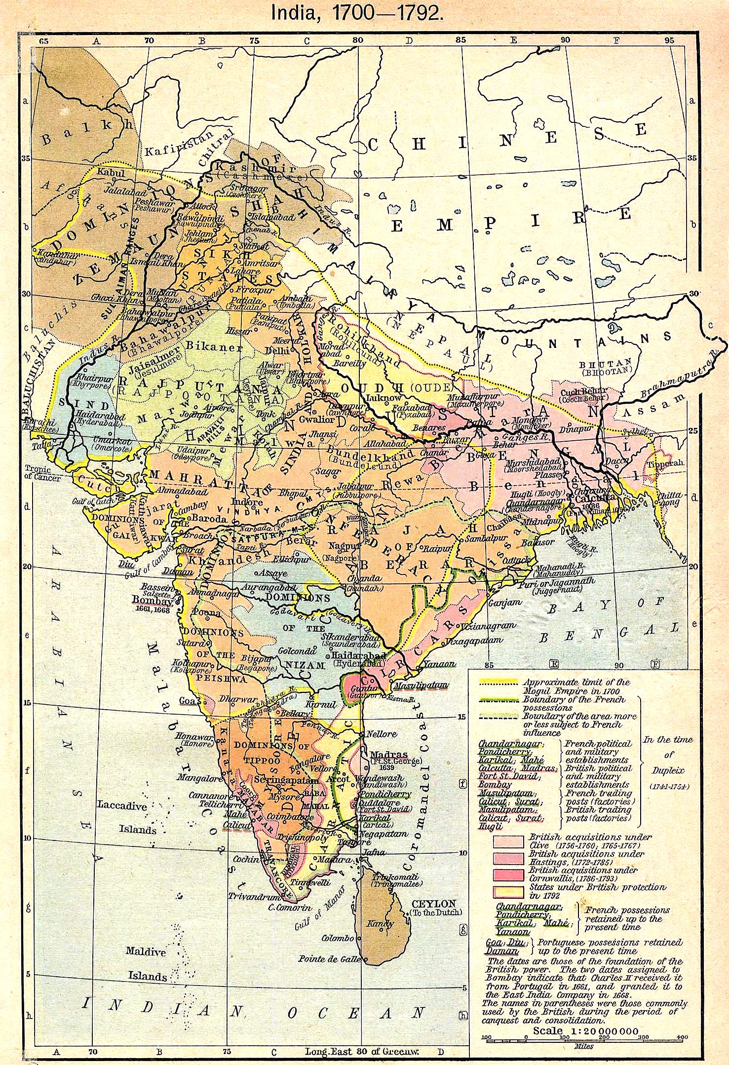
Image: India map 1700 1792
Size of this preview: 410 × 599 pixels. Other resolutions: 164 × 240 pixels | 1,477 × 2,158 pixels.
Original image (1,477 × 2,158 pixels, file size: 1.16 MB, MIME type: image/jpeg)
Description: A map of India during 1700–1793 AD
Title: India map 1700 1792
Credit: http://vol-news.com/tibet%20history/india_shepherd_1923.jpg
Author: V. & K.
Usage Terms: Public domain
License: Public domain
Attribution Required?: No
Image usage
The following page links to this image:

All content from Kiddle encyclopedia articles (including the article images and facts) can be freely used under Attribution-ShareAlike license, unless stated otherwise.