
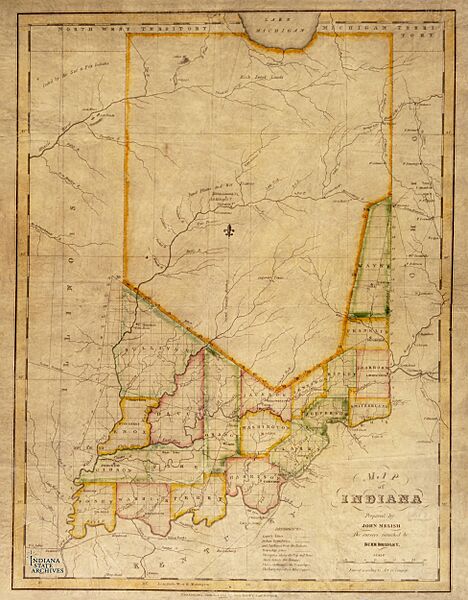
Image: Indiana, 1817

Size of this preview: 468 × 600 pixels. Other resolutions: 187 × 240 pixels | 3,900 × 5,000 pixels.
Original image (3,900 × 5,000 pixels, file size: 1.4 MB, MIME type: image/jpeg)
Description: An early map of Indiana
Title: Indiana, 1817
Credit: Digitized by Indiana State Archives, posted to Reddit: https://imgur.com/nsjsW7e
Author: "In 1816 mapmaker John Melish initiated a project to produce a map for each state and territory then in the Union. The Indiana map was the first one that Melish published in 1817."
Usage Terms: Public domain
License: Public domain
Attribution Required?: No
Image usage
The following page links to this image:

All content from Kiddle encyclopedia articles (including the article images and facts) can be freely used under Attribution-ShareAlike license, unless stated otherwise.