
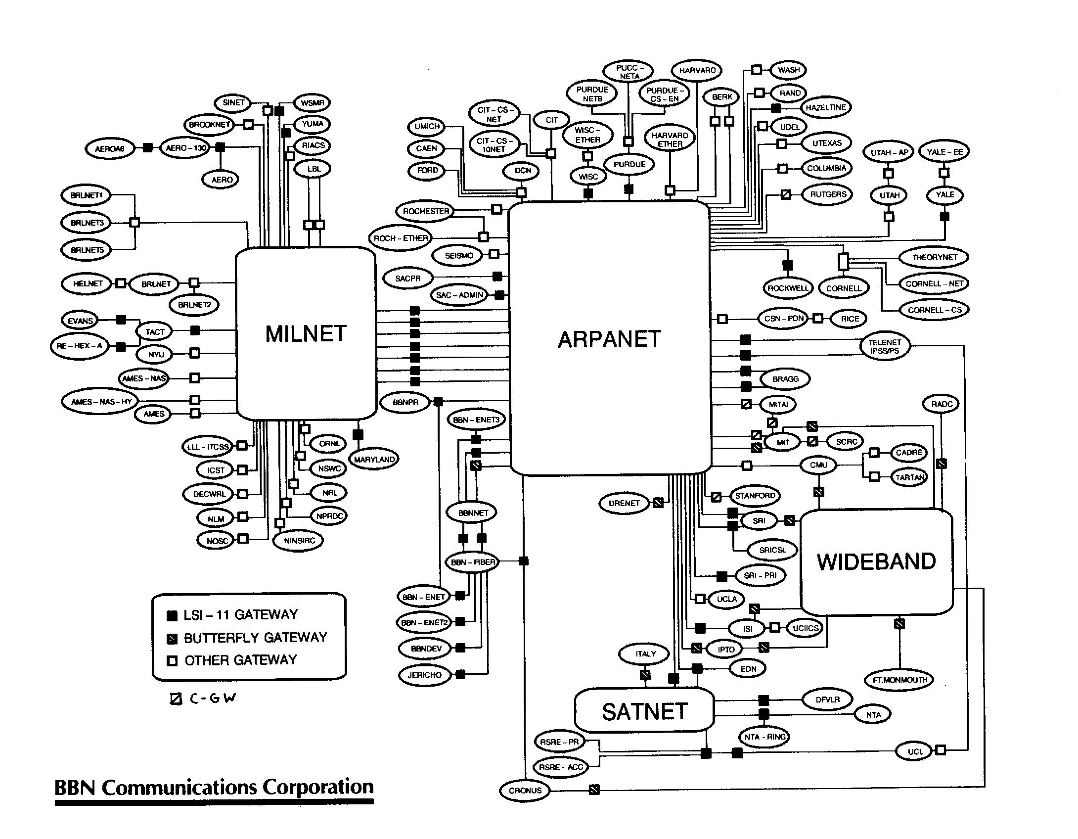
Image: InetCirca85
Size of this preview: 771 × 600 pixels. Other resolutions: 309 × 240 pixels | 2,180 × 1,696 pixels.
Original image (2,180 × 1,696 pixels, file size: 445 KB, MIME type: image/jpeg)
Description: Contemporary map of the entire Internet, circa late-1985/early-1986. The little squares are routers, the small ovals are sites/networks (some sites included more than one physical network), and the large shapes are long-haul backbones. No individual hosts are shown. See the image's talk page for email from Bob with more details about its creation.
Title: InetCirca85
Credit: A presentation given at the second IETF meeting
Author: Bob Hinden of Bolt, under US government contract (and so PD)
Permission: Public domain
Usage Terms: Public domain
License: Public domain
Attribution Required?: No
Image usage
The following page links to this image:

All content from Kiddle encyclopedia articles (including the article images and facts) can be freely used under Attribution-ShareAlike license, unless stated otherwise.