
Image: Internet map in February 82
Size of this preview: 456 × 599 pixels. Other resolutions: 183 × 240 pixels | 832 × 1,093 pixels.
Original image (832 × 1,093 pixels, file size: 18 KB, MIME type: image/png)
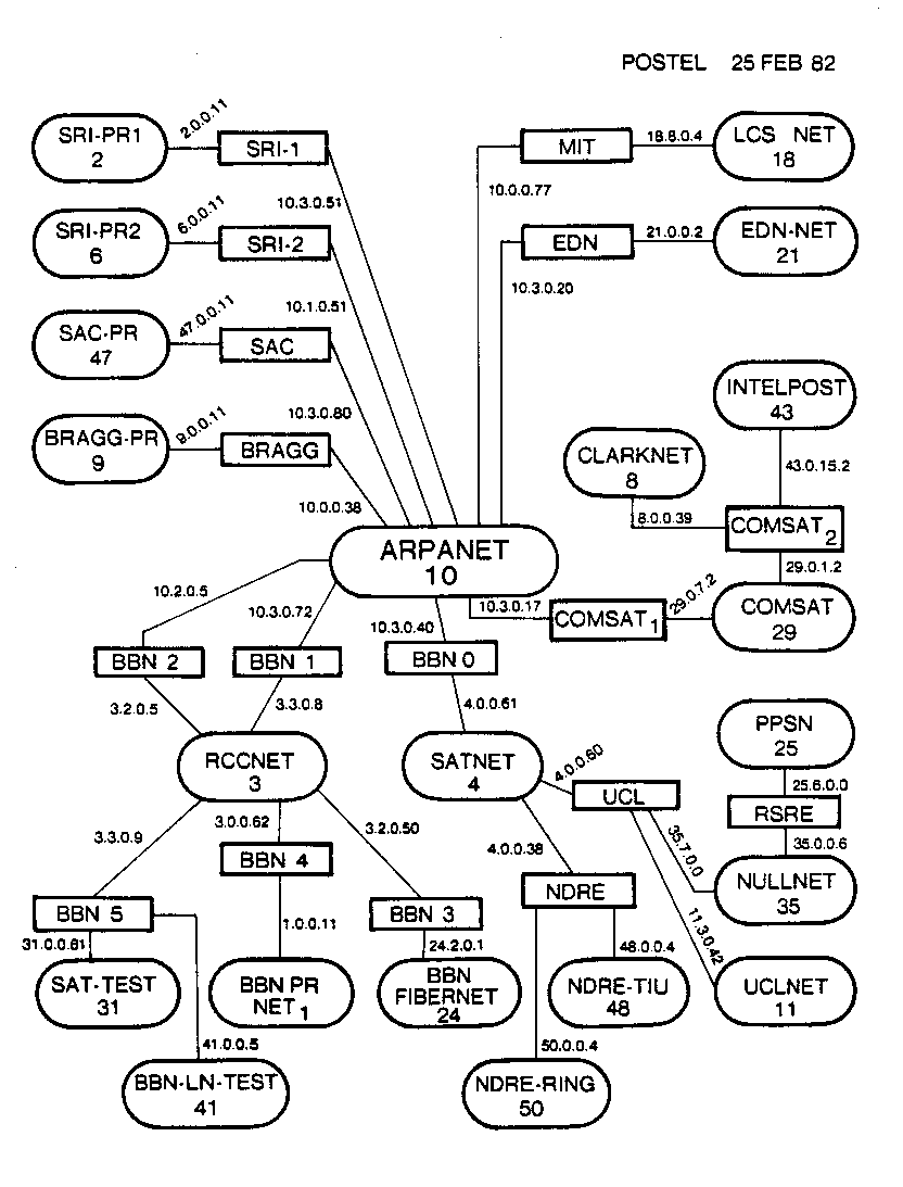
Description: Contemporary map of the entire Internet in semi-production phase (many hosts attached to the ARPANET were still using NCP at this point) in February 1982. The ovals are sites/networks (some sites included more than one physical network), the rectangles are individual routers. No individual hosts are shown. Drawn by Jon Postel of the Information Sciences Institute, under a DARPA research contract as part of Internet development.
Title: Internet map in February 82
Credit: Information Sciences Institute
Author: Jon Postel
Permission: PD-USGov-Military
Usage Terms: Public domain
License: Public domain
Attribution Required?: No
Image usage
The following 2 pages link to this image:

All content from Kiddle encyclopedia articles (including the article images and facts) can be freely used under Attribution-ShareAlike license, unless stated otherwise.