
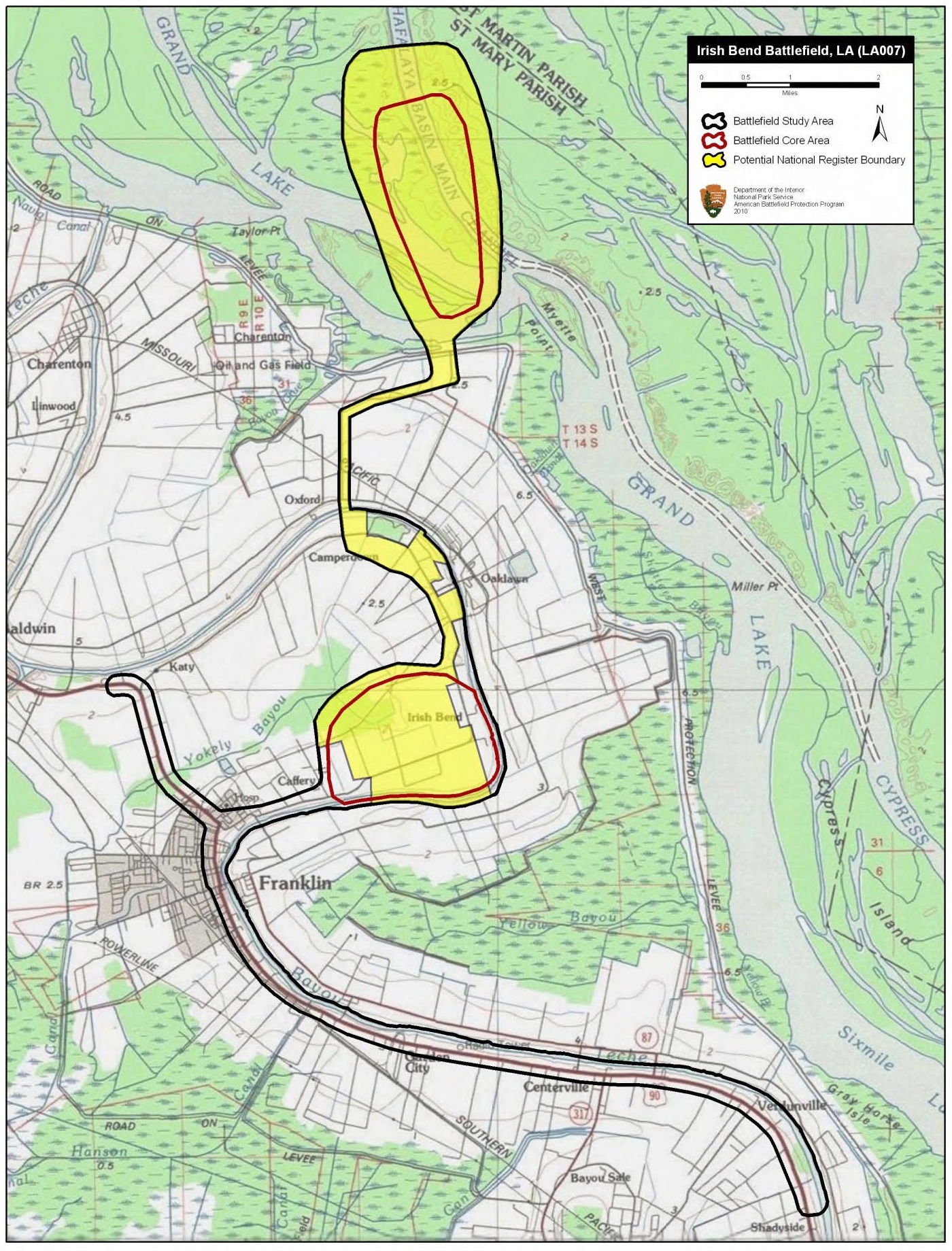
Image: Irish Bend Battlefield Louisiana
Size of this preview: 456 × 599 pixels. Other resolutions: 182 × 240 pixels | 1,400 × 1,840 pixels.
Original image (1,400 × 1,840 pixels, file size: 889 KB, MIME type: image/jpeg)
Description: Map of battlefield core and study areas. The revised Study Area includes the locations of the Federal landing north of the battlefield and the subsequent naval action at Grand Lake. The southern Core Area was shortened to the point where the CSS Diana engaged the flank of the Federal line. The ABPP added a new Core Area to the north to include the area where Federal naval forces sank the CSS Queen of the West.
Title: Irish Bend Battlefield Louisiana
Credit: National Park Service
Author: American Battlefield Protection Program
Usage Terms: Public domain
License: Public domain
Attribution Required?: No
Image usage
The following page links to this image:

All content from Kiddle encyclopedia articles (including the article images and facts) can be freely used under Attribution-ShareAlike license, unless stated otherwise.