
Image: Istakhri map 2

Size of this preview: 549 × 600 pixels. Other resolutions: 220 × 240 pixels | 550 × 601 pixels.
Original image (550 × 601 pixels, file size: 259 KB, MIME type: image/jpeg)
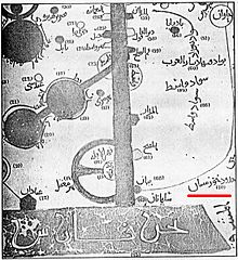
Description: 9th century map showing Khuzestan. Map was extracted (scanned) by Zereshk, from copy of "Al-aqaleem" by Istakhri, re-print of 1839, located at Iran National Museum's Library.
Title: Istakhri map 2
Author: Estakhri
Permission: Released under the GNU Free Documentation License.
Usage Terms: Creative Commons Attribution-Share Alike 3.0
License: CC-BY-SA-3.0
License Link: http://creativecommons.org/licenses/by-sa/3.0/
Attribution Required?: Yes
Image usage
The following page links to this image:

All content from Kiddle encyclopedia articles (including the article images and facts) can be freely used under Attribution-ShareAlike license, unless stated otherwise.