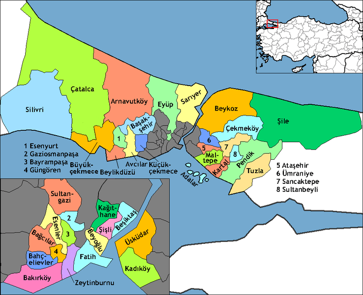
Image: Istanbul districts
Description: Map of the districts of İstanbul province in Turkey. Created by Rarelibra 20:58, 1 December 2006 (UTC) for public domain use, using MapInfo Professional v8.5 and various mapping resources. Further edited by One Homo Sapiens Effective 2009, shows new Arnavutköy, Ataşehir, Başakşehir, Beylikdüzü, Çekmeköy, Esenyurt, Sancaktepe, and Sultangazi districts. Elimination of Eminönü district, and boundary adjustments to Avcılar, Büyükçekmece, Çatalca, Esenler, Eyüp, Fatih, Gaziosmanpaşa, Kadıköy, Kartal, Küçükçekmece, Pendik, Silivri, Ümraniye, and Üsküdar districts. Source: İstanbul Büyükşehir Belediyesi [ibb-gov-tr].
Title: Istanbul districts
Credit: No machine-readable source provided. Own work assumed (based on copyright claims).
Author: No machine-readable author provided. Rarelibra assumed (based on copyright claims).
Usage Terms: Public domain
License: Public domain
Attribution Required?: No
Image usage
The following page links to this image:


