
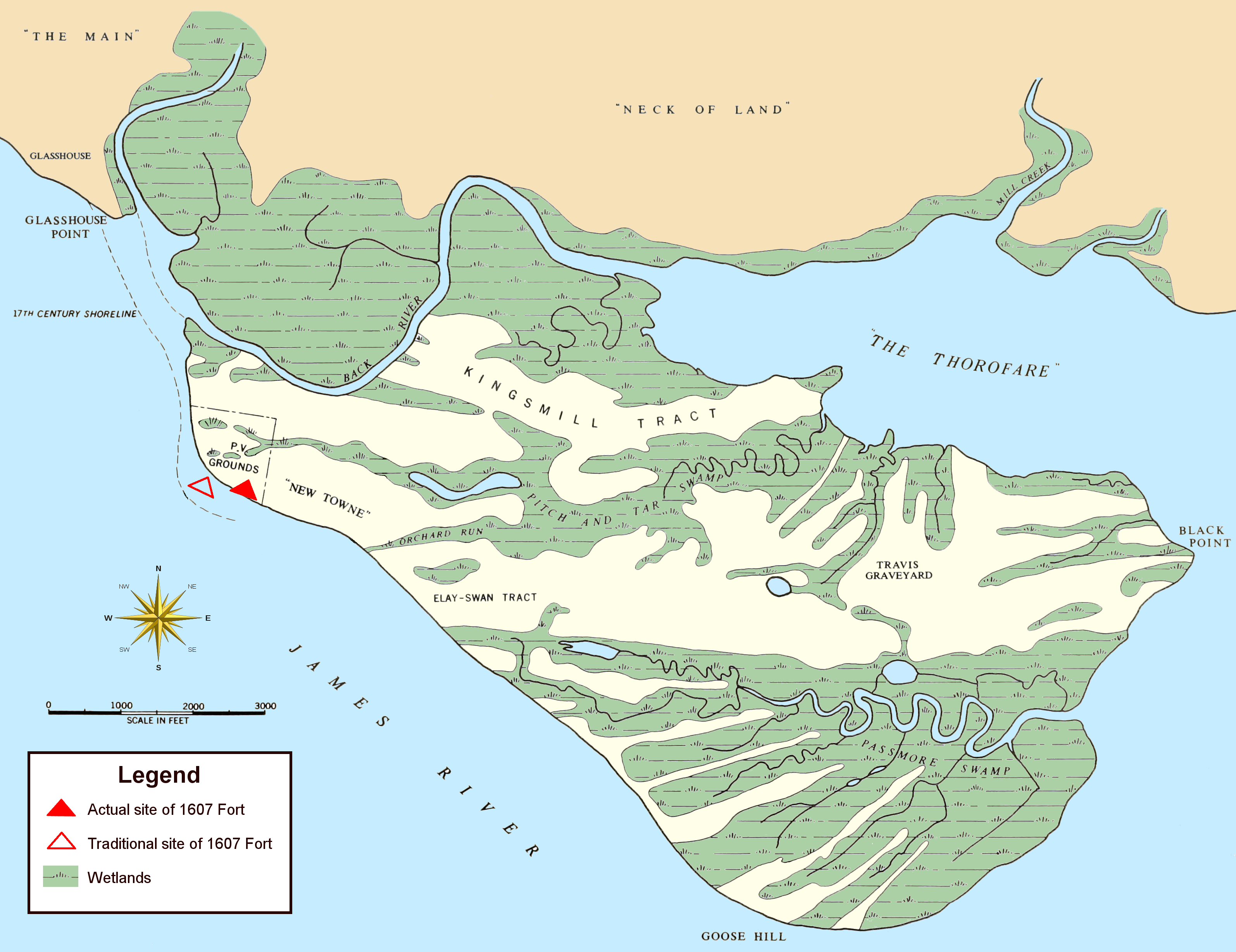
Image: Jamestown Island (1958 base map)
Description: Map showing terrain of Jamestown Island (as it appeared in the middle of the 20th century). Note: roads and the causeway bridge linking the island to Glasshouse Point are not pictured. Indicated are the location where the 1607 James Fort was discovered (in 1994), as well as where it had traditionally thought to have been located.
Title: Jamestown Island (1958 base map)
Credit: Page X of Archeology Evidence at Jamestown" by the National Park Service, available at the Internet Archive *File:Maps template-en.svg (compass rose)
Author: National Park Service: base map *Maps_template-fr.svg: Eric Gaba (Sting - fr:Sting) *derivative work: bamse (talk)*User:Morgan Riley: coloration, clean-up, legend, and arrangement
Permission: This image or media file contains material based on a work of a National Park Service employee, created as part of that person's official duties. As a work of the U.S. federal government, such work is in the public domain in the United States. See the NPS website and NPS copyright policy for more information. The compass rose source has been released as follows: This file is licensed under the Creative Commons Attribution 2.5 Generic license. You are free: to share – to copy, distribute and transmit the work to remix – to adapt the work Under the following conditions: attribution – You must attribute the work in the manner specified by the author or licensor (but not in any way that suggests that they endorse you or your use of the work). http://creativecommons.org/licenses/by/2.5 CC BY 2.5 Creative Commons Attribution 2.5 truetrue
Usage Terms: Public domain
License: Public domain
Attribution Required?: No
Image usage
The following 3 pages link to this image:

.png)