
Image: JerseyCity,Bergen,City,Greenville1860f
Size of this JPG preview of this TIF file: 681 × 599 pixels. Other resolution: 273 × 240 pixels.
Original image (818 × 720 pixels, file size: 840 KB, MIME type: image/tiff)
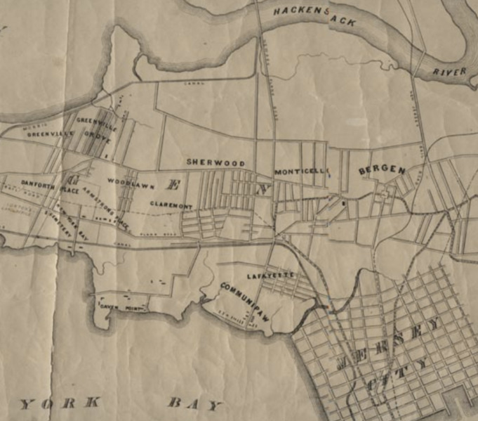
Description: Detail of 1860 map of Jersey City, Bergen City, and Greenville in Hudson County, New Jersey before consolidation completed in 1873 (with each other and Hudson City). Newark Bay/Hackensack River (top) and Upper New York Bay (below) were later extensively filled further expanding the land area.
Title: JerseyCity,Bergen,City,Greenville1860
Credit: https://www.njcu.edu/programs/jchistory/Pages/G_Pages/Greenville2.htm
Author: Unknown authorUnknown author
Usage Terms: Public domain
License: Public domain
Attribution Required?: No
Image usage
The following page links to this image:

All content from Kiddle encyclopedia articles (including the article images and facts) can be freely used under Attribution-ShareAlike license, unless stated otherwise.