
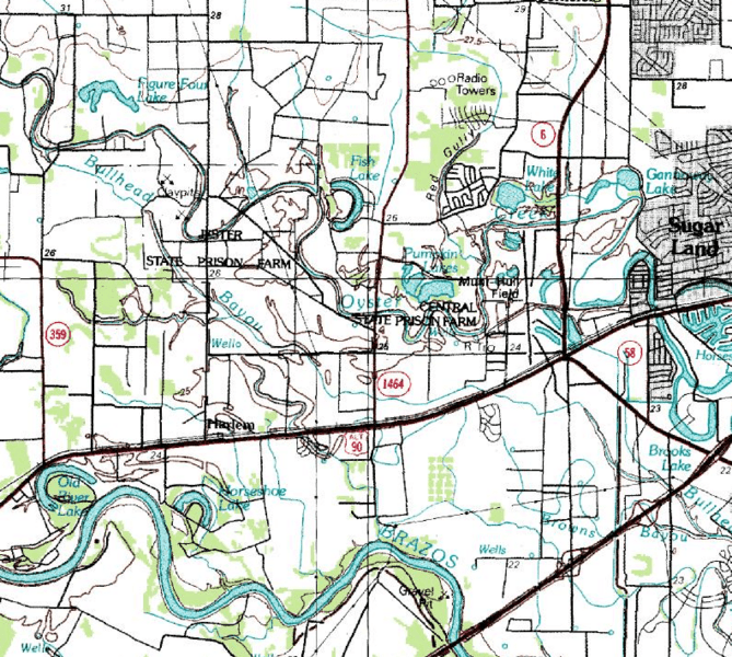
Image: JesterHarlemPrisonFarmFortBendCoTx

Size of this preview: 669 × 600 pixels. Other resolutions: 268 × 240 pixels | 792 × 710 pixels.
Original image (792 × 710 pixels, file size: 397 KB, MIME type: image/png)
Description: USGS topographic mapof the Jester (Harlem) Prison Farm (Jester (Harlem) I, Vance (Jester/Harlem II), Jester III, and Jester IV units), the Central (Imperial) Prison Farm (Central Unit), and Sugar Land Municipal Airport/Hull Field in Tecas
Title: JesterHarlemPrisonFarmFortBendCoTx
Credit: USGS The National Map, via MSR Maps (formerly TerraServer-USA) http://msrmaps.com/image.aspx?t=2&s=14&x=75&y=1024&z=15&w=3&qs=%7cSugar+Land%7cTX%7c
Author: United States Geological Survey (USGS)
Permission: Public domain
Usage Terms: Public domain
License: Public domain
Attribution Required?: No
Image usage
The following page links to this image:

All content from Kiddle encyclopedia articles (including the article images and facts) can be freely used under Attribution-ShareAlike license, unless stated otherwise.