
Image: Joaquin 2015-10-01 1145z
Size of this preview: 600 × 600 pixels. Other resolutions: 240 × 240 pixels | 1,600 × 1,600 pixels.
Original image (1,600 × 1,600 pixels, file size: 2.88 MB, MIME type: image/png)
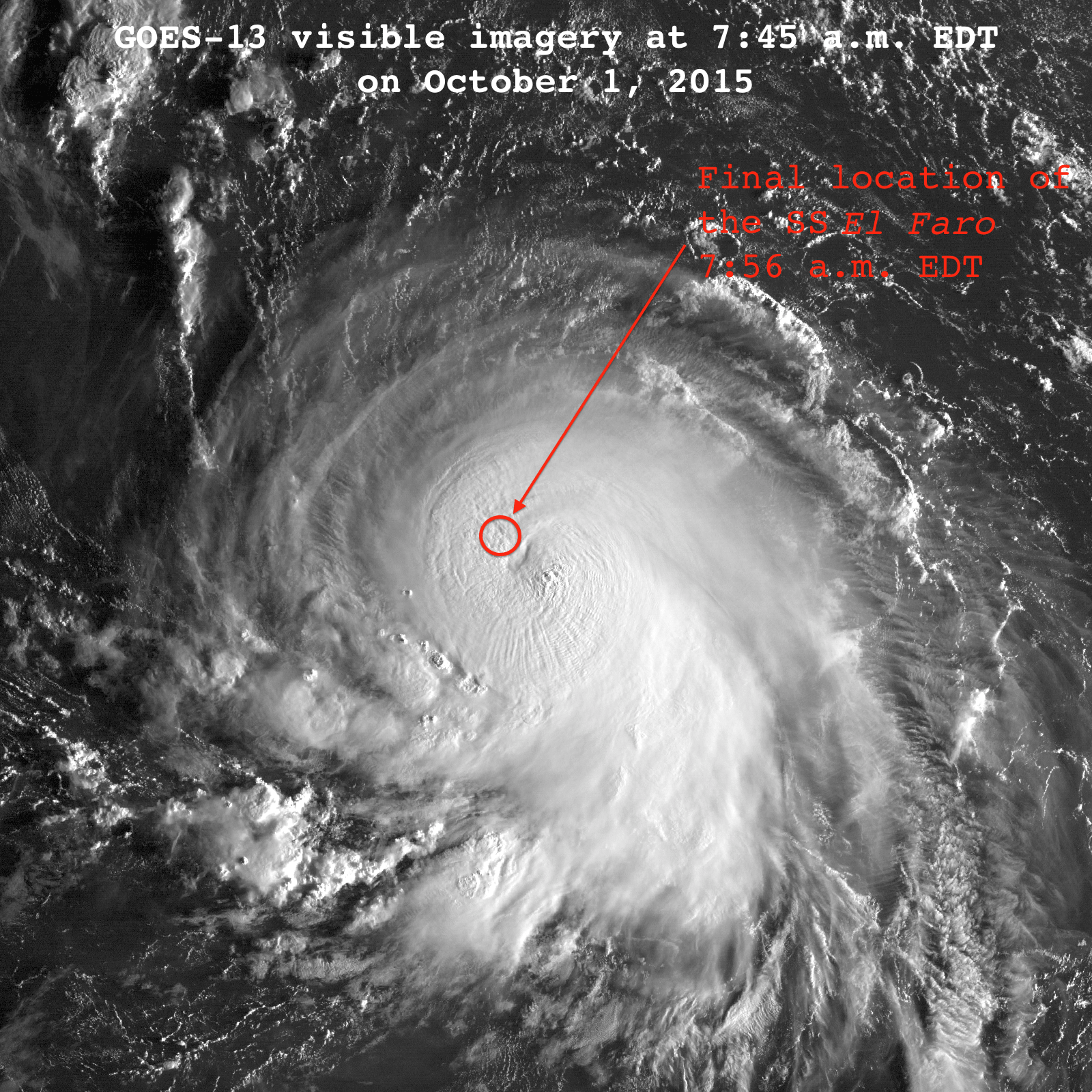
Description: Visible satellite imagery of Hurricane Joaquin at 11:45 UTC October 1, 2015. The SS El Faro was lost in the hurricane around this time, with its final position reported in the northwestern eyewall. Image is slightly modified from original to include annotations. Approximate location of the SS El Faro was obtained from Reuters via WUnderground.
Title: Joaquin 2015-10-01 1145z
Credit: http://www.nrlmry.navy.mil/archdat/test/kml/TC/2015/ATL/11L/visir/
Author: National Oceanic and Atmospheric Administration; provided via the United States Navy
Usage Terms: Public domain
License: Public domain
Attribution Required?: No
Image usage
The following page links to this image:

All content from Kiddle encyclopedia articles (including the article images and facts) can be freely used under Attribution-ShareAlike license, unless stated otherwise.