
Image: Joseph Vallot cartography
No higher resolution available.
Joseph_Vallot_cartography.jpg (477 × 462 pixels, file size: 137 KB, MIME type: image/jpeg)
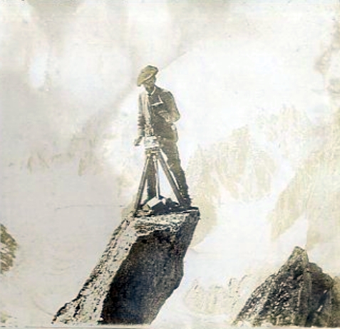
Description: French scientist, Joseph Vallot, taking bearings for the preparation of a detailed 1:20,000 scale map of the Mont Blanc massif. The project was led by his cousin, the engineer Henri Vallot, circa 1892-1902. The maps themselves were published in many parts, between 1925 and 1935.
Title: Joseph Vallot cartography
Credit: https://www.mountainmuseums.org/fr/items/joseph-vallot-prenant-les-visees-pour-la-carte-des-alpes/
Author: Unknown authorUnknown author
Usage Terms: Public domain
License: Public domain
Attribution Required?: No
Image usage
The following page links to this image:

All content from Kiddle encyclopedia articles (including the article images and facts) can be freely used under Attribution-ShareAlike license, unless stated otherwise.